CONCRETE ARROW QUEST : Search for Transcontinental Airway Beacons

wayoflife

Administrator
Staff member
"Pogonip is freezing fog, formed by fine ice crystals floating in the air. It is a fairly common phenomenon in the Reno / Tahoe area during cold temperatures after a heavy snowfall. Pogonip results from a combination of high humidity and below freezing temperatures. It can be quite thick, making for hazardous driving conditions. On the plus side, pogonip frequently covers everything with a beautiful layer of fine ice crystals. Pogonip is from the Shoshone word meaning "cloud." Another interpretation is that it means "white death," which is what can happen to people who become helplessly lost in the fog and expire from exposure."

:cheesy: That's awesome! Thanks for posting that up :crazyeyes:

This one is located about 55 miles north east of as Vegas, next trip out to Logandale now has a small side trip up Beacon Hill road. http://goo.gl/maps/BuPJg

I've heard of this one and one up by Glendale. I hope to check them out the next time I'm in the area.

http://sometimes-interesting.com/2013/12/04/concrete-arrows-and-the-u-s-airmail-beacon-system/ This site has gps coordinates for the arrows. And this is pretty Damn cool.

Sent from the"Zone of Influence"

Hey now, that's a link I had not found in my searches. Thanks for posting that up. I just hope the sites are still in good shape. Seems that anytime GPS coordinates are available, the site get trashed, shot up and burned to the ground. :grayno:
 

wayoflife

Administrator
Staff member
This looks like a great adventure guys! I love the little glimpse into the past and never would have guessed those were out there. Like Russ, both of my grandfathers and my dad were aviators and never spoke of these.

I'm pretty sure these beacons were primarily used for the Postal Service and that might be a reason why they didn't know about it.

Awesome.

What was the concrete tunnel for/from ?

.

LOL!! Good eye. The tunnel looked like an FM access passage that crossed under the Interstate. It wasn't a destination of ours but we were glad to have found it. :yup:

It's your best historical photo essay to date. For me at least, this is the essence of off road adventure. The pre-trip research effort, finding the arrows, and then the discovery of the crown jewel, the tower, is fantastic. Cindy and Eddie, the both of you truly are "old souls", and I mean that in the best way possible. All "10's" on this one.:thumb::thumb:

LOL!! You are too kind, thank you :blush:

Didn't you once mention that you were studying to be an architect when you were younger? Is that why, even though these sites and old buildings are neat, they seem especially interesting to you?

Actually, I was an architect but, I think sites like these are interesting to me because I just really like history. A lot of that is probably from the fact that my folks loved it too and used to drag me around the country as a kid exploring places like this too. I guess the bug stuck :yup:
 

bl17z90

New member
Actually, I was an architect but, I think sites like these are interesting to me because I just really like history. A lot of that is probably from the fact that my folks loved it too and used to drag me around the country as a kid exploring places like this too. I guess the bug stuck :yup:

It really fits for a Jeeper to be into these things. I was talking to my wife after reading this thread about doing something similar to this. It would be so neat to drive out into nowhere and find things like this.

Good job and thanks for sharing.
 

locrwln

New member
Awesome write up. I too just learned about these a month or so ago. Haven't had a chance to start my hunt. Isn't Northern Nevada great??? Been out exploring it for 20 years and still find new and different places to add to the list.

Jack
 

JeepFan

Hooked
Obsessed with Beacons

Ever since Eddie posted up about the Airway Beacons I've been kind of obsessed with finding them. :crazyeyes: Come to find out there are hundreds if not thousands of them scattered across the US. As Eddie mentioned the transcontinental airway system initially connected the east coast with San Francisco. This route generally followed the the Union Pacific Railroad. By the mid 1930's additional routes were added. The California Desert had its share of beacons and airfields linking Los Angeles and Southern California.

Since we live in the High Desert (Palmdale, CA) I decided to ask Google if any of these beacons ever existed in the Antelope Valley. Well, low an behold there were two of them. In fact, there was one not more than a 1/4 mile from our first house in an area called Lovejoy Buttes. (N34 35 46.14720 W117 51 36.16555) located one mile west of Lake Los Angeles in the Antelope Valley. We lived there for about 6 years and I never heard of these beacons until Eddie mentioned them in this thread.

Since it is located only 20 minutes from where we live now, Steph and I decided to take a ride out to beautiful :eek: Lake Los Angeles and see what we could find. Unfortunately we only found remnants of a Beacon that once stood at the highest peak in Lake LA. Here are a few pics from our short adventure...

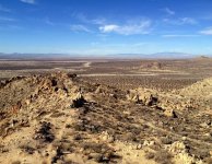
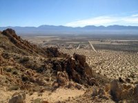
This was a close as we could get to the peak but there are a few hiking trails leading up to the actual site...Can you find our Jeep?
Found a Jeep.jpg

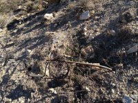
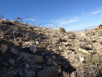
All that is left are some cables and what looks like a piece of a telegraph pole.
Cable.jpg

Cables 2.jpg

Looking South East.jpg

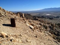
Here's a view from the peak looking South. Our old house is on the North end of the wide Street in the center of the pic.
Looking South Lake LA.jpg

Here's a panoramic view from the peak looking West towards Palmdale Lancaster.

Palmdale Lancaster.jpg

My search continues and I will be posting more pictures of these interesting Beacons when we find them.
 

wayoflife

Administrator
Staff member
Ever since Eddie posted up about the Airway Beacons I've been kind of obsessed with finding them. :crazyeyes: Come to find out there are hundreds if not thousands of them scattered across the US. As Eddie mentioned the transcontinental airway system initially connected the east coast with San Francisco. This route generally followed the the Union Pacific Railroad. By the mid 1930's additional routes were added. The California Desert had its share of beacons and airfields linking Los Angeles and Southern California.

Since we live in the High Desert (Palmdale, CA) I decided to ask Google if any of these beacons ever existed in the Antelope Valley. Well, low an behold there were two of them. In fact, there was one not more than a 1/4 mile from our first house in an area called Lovejoy Buttes. (N34 35 46.14720 W117 51 36.16555) located one mile west of Lake Los Angeles in the Antelope Valley. We lived there for about 6 years and I never heard of these beacons until Eddie mentioned them in this thread.

Since it is located only 20 minutes from where we live now, Steph and I decided to take a ride out to beautiful :eek: Lake Los Angeles and see what we could find. Unfortunately we only found remnants of a Beacon that once stood at the highest peak in Lake LA. Here are a few pics from our short adventure...

:cheesy: Sorry, didn't mean to infect you with the bug that drives you to go out and find these things. :crazyeyes: Thanks for posting this up though, I've been cataloging as many of these as I can find online and then trying to do Google Earth checks to see if I can find anymore. Definitely need to get out and find some of the ones between LA and St. George - about as far as I've gotten down south in my searches. :crazyeyes:
 

JeepFan

Hooked
:cheesy: Sorry, didn't mean to infect you with the bug that drives you to go out and find these things. :crazyeyes: Thanks for posting this up though, I've been cataloging as many of these as I can find online and then trying to do Google Earth checks to see if I can find anymore. Definitely need to get out and find some of the ones between LA and St. George - about as far as I've gotten down south in my searches. :crazyeyes:

No your not! :cheesy: but I'm so glad you did... Yea, I think I'm going insane looking for these things. Check this out...
https://maps.google.com/maps/ms?msa=0&msid=202130970324553563885.0004e5b7a5774649883e8&dg=feature

Yes, definitely need to get out and find more of these. Stay tuned. :crazyeyes::shock::doh::beer:
 
Last edited:

espi

New member
This is so awesome I love history stuff like this. My Father-in-law always talked about taking a road trip cross country to check out old forts. Since he passed this March I feel it is something I must do with my son when he gets older
 

pastorwug

New member
No your not! :cheesy: but I'm so glad you did... Yea, I think I'm going insane looking for these things. Check this out...
https://maps.google.com/maps/ms?msa=0&msid=202130970324553563885.0004e5b7a5774649883e8&dg=feature

Yes, definitely need to get out and find more of these. Stay tuned. :crazyeyes::shock::doh::beer:

These coordinates are showing beacon towers as well as the arrows?
I've checked out the sites near me via Google and they all appear to be on private land but going to go and hopefully get permission to go out and look.

Thanks for the info!
I had other things planned today but now my wife and I want to go exploring!
 

JeepFan

Hooked
These coordinates are showing beacon towers as well as the arrows?
I've checked out the sites near me via Google and they all appear to be on private land but going to go and hopefully get permission to go out and look.

Thanks for the info!
I had other things planned today but now my wife and I want to go exploring!

I believe it is showing both arrows and beacons. You can use Google Earth to see whats there...

I think I started an epidemic! :crazyeyes: :cheesy:
 

piginajeep

The Original Smartass
I believe it is showing both arrows and beacons. You can use Google Earth to see whats there...

I think I started an epidemic! :crazyeyes: :cheesy:

I found one on the map near my old home town in Ohio. The road name it's near is Signal Rd. I don't believe anything is left.

It's on the flight path to Pittsburgh
 

wayoflife

Administrator
Staff member
No your not! :cheesy: but I'm so glad you did... Yea, I think I'm going insane looking for these things. Check this out...
https://maps.google.com/maps/ms?msa=0&msid=202130970324553563885.0004e5b7a5774649883e8&dg=feature

Yes, definitely need to get out and find more of these. Stay tuned. :crazyeyes::shock::doh::beer:

This link is great! How'd you find it? While it doesn't show a lot of the beacons, it does give you a complete point A to point B which helps a lot to help look for what's in between. Thanks for posting it up :thumb:

Dam you and you Google maps... just blew over an hour trolling cement arrows nearby! lol

LOL!! I hear there is one up in the hills near the M Casino. We plan on looking for it the next time we down visiting the in-laws. If you find it before then, please let us know where it is :yup:

Lol! It's addicting isn't it? Blame Eddie. :cheesy:

:cheesy: :crazyeyes: :D
 

wayoflife

Administrator
Staff member
These coordinates are showing beacon towers as well as the arrows?
I've checked out the sites near me via Google and they all appear to be on private land but going to go and hopefully get permission to go out and look.

Thanks for the info!
I had other things planned today but now my wife and I want to go exploring!

I believe it is showing both arrows and beacons. You can use Google Earth to see whats there...

I think I started an epidemic! :crazyeyes: :cheesy:

Yes, I do believe they are showing both arrows and beacon towers. You have to remember that a lot of the towers were originally built with an emergency landing strip next to it just in case. These would have been towers with green lights as opposed to the standard red. Many of these towers eventually became airports.

I found one on the map near my old home town in Ohio. The road name it's near is Signal Rd. I don't believe anything is left.

It's on the flight path to Pittsburgh

That's pretty cool. I read a blog where a guy was hiking up in PA and came across an arrow under a canopy of trees. There would have been no way to see it from the air but, there it was. Like us, he didn't know what it was until he did some research. It'd be cool to find one back east as it'd be a lot harder to find.
 

JeepFan

Hooked
This link is great! How'd you find it? While it doesn't show a lot of the beacons, it does give you a complete point A to point B which helps a lot to help look for what's in between. Thanks for posting it up :thumb:

I used the following search string in Google (google maps AND airway beacons) and voila! Amazing how many of these things were constructed. The US Postal service must have had an army of people building them. It seems all of the sites I located in my area are long gone. Funny you mentioned that quite a few of the locations are now airports. I found one that was located next to Plant 42 at the Palmdale Airport. With Google Earth you can see the layout of the pad where the tower and generator building once stood. Very Cool!

Now I'm trying to put together our top 5 runs of 2013. So hard to choose! :crazyeyes: Although Devils Canyon and Tahoe are easy choices for the number 1 and 2 spot. :yup:
 

OverlanderJK

Resident Smartass
Yes, I do believe they are showing both arrows and beacon towers. You have to remember that a lot of the towers were originally built with an emergency landing strip next to it just in case. These would have been towers with green lights as opposed to the standard red. Many of these towers eventually became airports.


That's pretty cool. I read a blog where a guy was hiking up in PA and came across an arrow under a canopy of trees. There would have been no way to see it from the air but, there it was. Like us, he didn't know what it was until he did some research. It'd be cool to find one back east as it'd be a lot harder to find.

I looked at google earth and most of the San Diego ones are covered with trees or nothing shows. Maybe I'll check some out this weekend.
 
Top Bottom