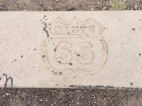
ROADSIDE AMERICA : Awesome Roadside Stops Along the Way!

wayoflife

Administrator
Staff member
The attractions we stopped at over the Christmas holiday when we traveled to and from Branson, Missouri.

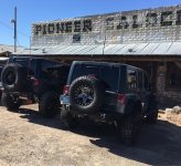
Damn, I just now started catching up on this thread and saw all these gems!! Man, I sure do miss traveling along ol' Route 66 - those are some awesome pics that you took of your Jeep next to the roadside attractions. Thanks for posting these up.

:thumb:
 

wayoflife

Administrator
Staff member
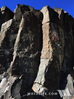
It's hard to imagine that there was a time where a simple trip from Los Angeles to Lone Pine could take as long as 2-3 days. At least, back in the 1920's, that's what it would have taken and because of it, towns such Little Lake was born. Once called "Little Owens Lake", the town stood at the southern most edge of the Owens Valley and was established next to a small ancient lake bearing the same name. Situated in a natural corridor leading up into the valley from the Mojave Desert, prospectors and early settlers a like used this location as a stopping point as they made their way to destinations such as Cerro Gordo and Darwin. Back in the early 20th Century, the Jawbone Branch of the Mojave to Lone Pine Southern Pacific Rail Road was located here and sportsman heading up US 395 would stop to top of their tanks, fill up their stomachs and rest at the old Little Lake Hotel. Unfortunately, the years haven't been kind to this quiet little roadside stop. In 1958, a divided 4-lane highway bypassed the town, rail service was discontinued in 1982, a fire destroyed the upper story hotel in 1989, the post office was closed in 1997 and a flash flood near about erased all that remained of the town in 1998.

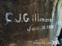
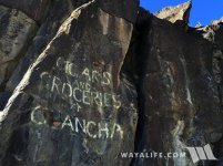
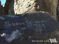
Our recent stop at this long forgotten destination was to check out some of the old advertisements for "cigars and groceries" that were painted onto the black basalt walls as well as a few old signatures left behind by travelers back in the early 1900's. It had been years since we were last here and as luck would have it, vandals haven't destroyed them yet and if anything, it looked like some effort had been made to preserve them and even erase modern graffiti left near by. Anyway, here are a few shots of what we found, I hope you enjoy.
IMG_0206.jpg

IMG_0209.jpg

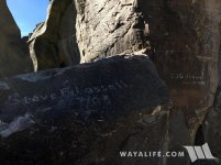
Steve Glassell and C.J. Gillmore left their signatures here over 100 years ago on June 10, 1906.
IMG_0210.jpg

IMG_0211.jpg

IMG_0213.jpg
 

JKRicky

Member
Great pics. Going out to the Mojave Desert for the first time this last weekend has really made me want to do a lot more exploring out there. So many awesome pieces of history out there to see. [emoji106]🏼
 

MR.Ty

Token East Coast Guy
Damn, I just now started catching up on this thread and saw all these gems!! Man, I sure do miss traveling along ol' Route 66 - those are some awesome pics that you took of your Jeep next to the roadside attractions. Thanks for posting these up.

:thumb:

Thank you very much! I am glad you enjoyed them. :yup:
 

catahoula

Caught the Bug
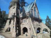
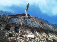
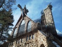
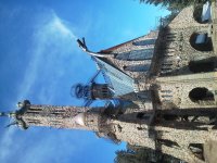
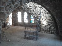
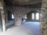
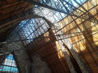
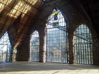
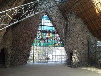
Visited Bishop Castle in Rye, Co.

IMG_20160105_111149.jpg

IMG_20160105_112003.jpg

IMG_20160105_105546.jpg

IMG_20160105_111526.jpg

IMG_20160105_110436.jpg

IMG_20160105_110345.jpg

IMG_20160105_110551.jpg

IMG_20160105_110527.jpg

IMG_20160105_110546.jpg

Sorry about the side way shot. Could not figure how to rotate.

Getting to the Castle:
The drive to Bishop Castle will take you over 9,200 feet above sea level along the Frontier Pathways Scenic and Historic Byway.

The easiest way to get to Bishop Castle is from I-25. Take exit #74 at Colorado City and head towards the mountains. (right off the exit ramp from the north and left off the exit ramp from the south) This puts you on Colorado state highway 165 and it's 24 miles without a turn to the Castle. You will see signs for the castle as you come upon it, and there's usually many cars out front.

The Scenic Route, from Colorado Springs, is to take Hwy. 115 south to Florence, turn left at the first traffic light onto Hwy. 67, turn right onto Hwy 96 in Wetmore and at the next junction you will see signs for Bishop Castle. Turn left there onto Hwy. 165 and it's 12 miles.

Bishop Castle can also be reached from the Salida area by heading east on Hwy. 50 to Texas Creek and turning right onto Hwy. 69 into Westcliffe. Turn left once in Westcliffe onto Hwy. 96 and travel until you see the Bishop Castle signs at the junction with Hwy. 165. Turn right and it's 12 miles.
 

catahoula

Caught the Bug
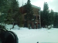
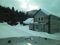
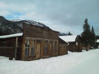
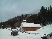
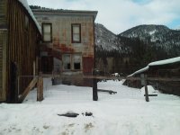
St. Elmo ghost town. You drive though a part of San Isabel Forest to get there. We were the only souls out there. Summer months you can hand feed the chipmunks sunflower seeds.

IMG_20160105_152053.jpg

IMG_20160105_152040.jpg

IMG_20160105_152413.jpg

IMG_20160105_152315.jpg

IMG_20160105_152408.jpg

IMG_20160105_152237.jpg

IMG_20160105_152735.jpg
 

blackrubi14

Member
St. Elmo ghost town. You drive though a part of San Isabel Forest to get there. We were the only souls out there. Summer months you can hand feed the chipmunks sunflower seeds.

Awesome pics, thanks for sharing! We go to the Salida area every year in August for our annual week long camping/exploring trip. San Isabel Forest is one of our more favorite in the area. St. Elmo is a pretty cool ghost town.
 

catahoula

Caught the Bug
Awesome pics, thanks for sharing! We go to the Salida area every year in August for our annual week long camping/exploring trip. San Isabel Forest is one of our more favorite in the area. St. Elmo is a pretty cool ghost town.

Thanks! It is beautiful and maybe our paths will cross sometime there.
 

Gadget

Caught the Bug
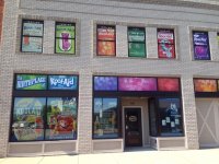
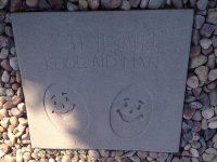
Got sent to Hastings Nebraska for a few days for work and took the opportunity to track down a few things that were close by: ImageUploadedByWAYALIFE1468257108.048115.jpg did not know it was the birthplace of Kool Aid, and his feet in cement: ImageUploadedByWAYALIFE1468257168.131359.jpg . There is a museum there that has a Kool Aid man suit but it was closed by the time I got there.
 

notnalc68

That dude from Mississippi
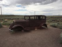
In Petrified National Forest, near I-40, an old Studebaker, sitting alongside what was once, Route 66.

ImageUploadedByWAYALIFE1472246834.512954.jpg

A concrete marker sits where the highway was.

ImageUploadedByWAYALIFE1472246873.668212.jpg
 
Top Bottom