Months after the final Golden Spike was hammered into place and the very first transcontinental railroad was open for service, an avalanche near Donner Summit damaged hundreds of feet of track and a subsequent blizzard left miles more buried under deep snow. Service on the railroad ground to a halt for weeks and as soon as the snows thawed, 42 miles of snowsheds would be built by the Central Pacific Railroad to protect their line. Initally constructed out out of 65 million board feet of lumber, the original snowsheds were soon replaced with stonger and fire resistant concrete structures and, are what you can find still standing today.
For 130 years, Central Pacific, Southern Pacific, Union Pacific, and AMTRAK ran trains though these snowsheds and was only abandoned and left to sit idle back in 1997. Up the summer of 2012, you could actually drive your Jeep through these amazing snowsheds but, for one reason or another, Union Pacific finally decided to construct a permanent barrier and block off vehicular access. Lucky for us, we were able to take Moby through one last time before they were closed and, these are some pics we took our final trip through. I hope you enjoy.
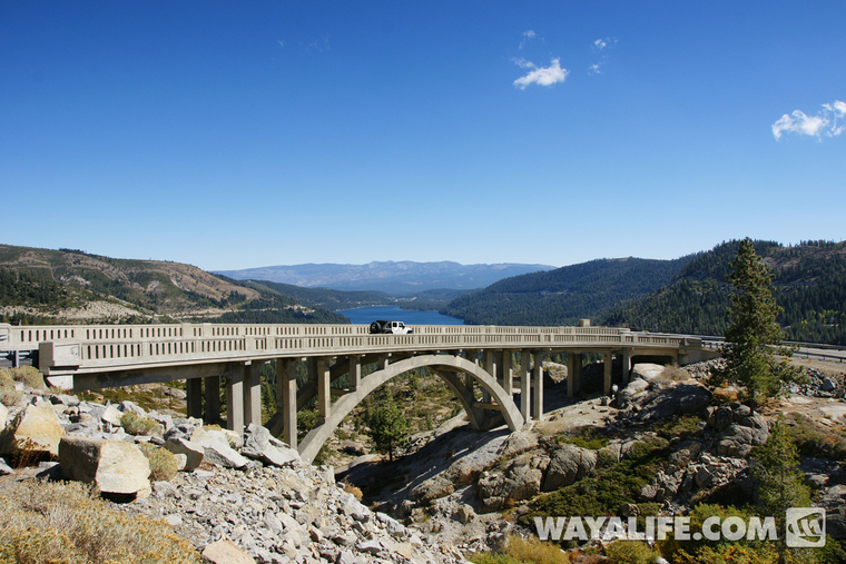
Before heading into the snowsheds, we took some time to explore the surrounding area just outside of them. Here you can see Moby crossing over the old Lincoln Highway Donner Summit Rainbow Bridge which was built in 1926...
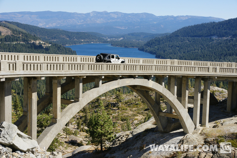
View driving across this wonderful bridge, something that would not have been possible without the help of the Nevada County Board of Supervisors who helped provide $1.6 million to have it restore back in 1993...
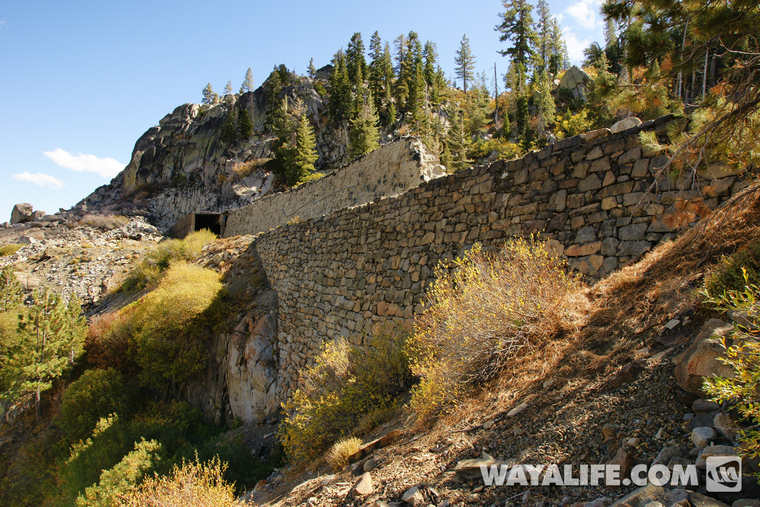
Hiking up to the "Chinese Wall". This lower half stands 75 feet tall and was made almost entirely by hand...
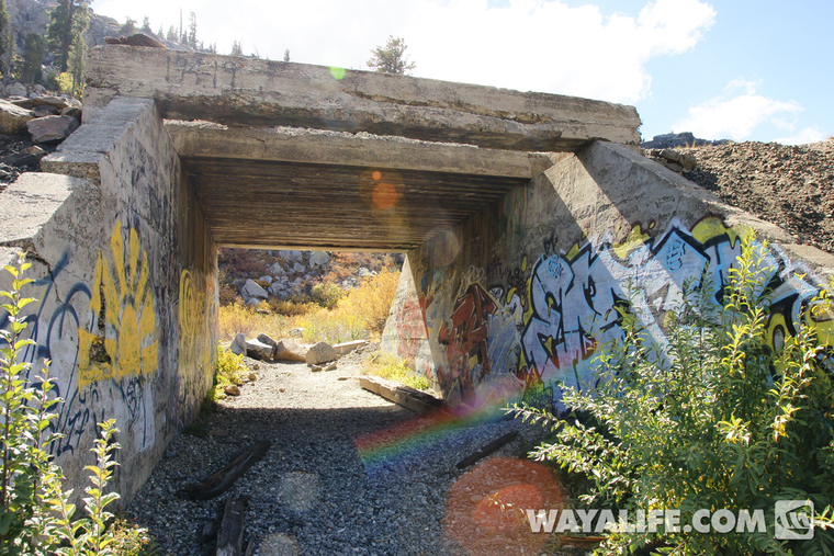
Shot of an old underpass that was constructed back in 1914 and provided vehicular passage along the old Donner Pass Road before the completion of Highway 40 and the Donner Summit Bridge in 1926...
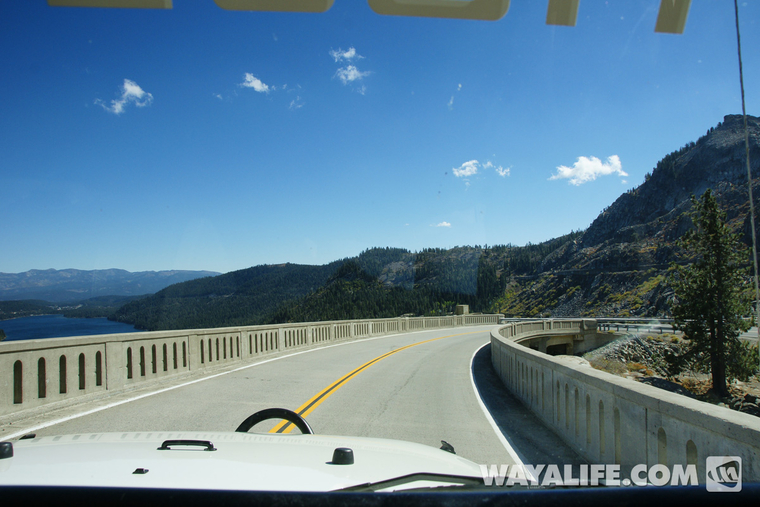
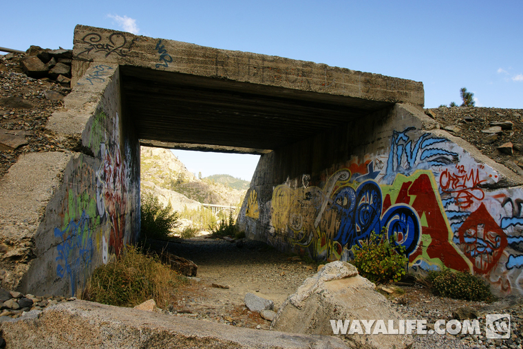
View from the other side - notice the Donner Summit Rainbow bridge in the distance...
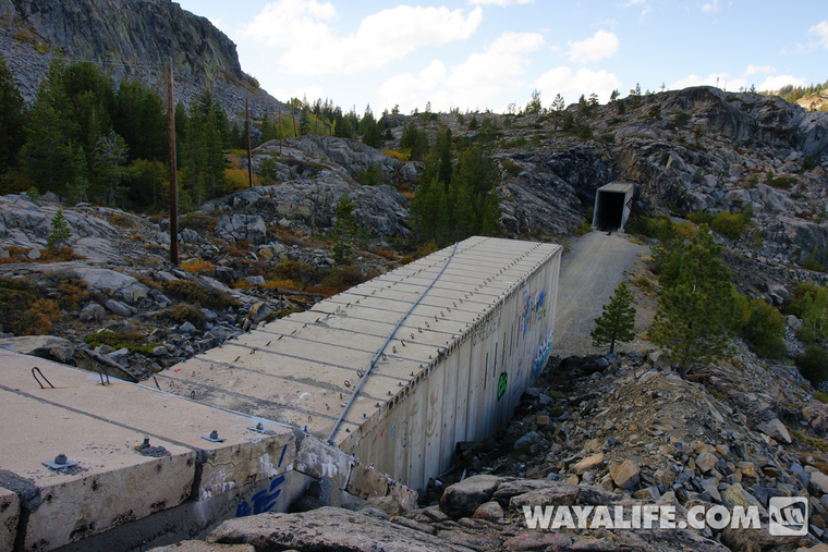
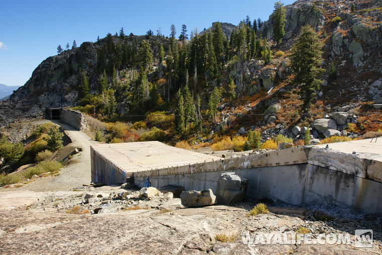
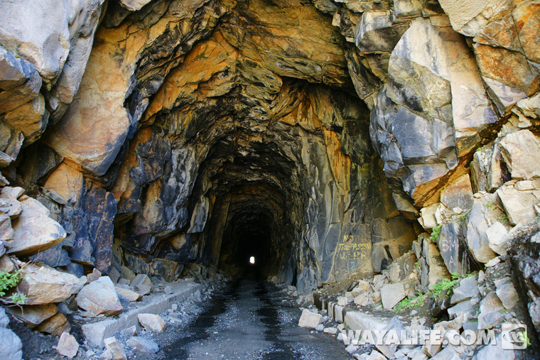
View looking through the concrete Tunnel #7 with Tunnel #6, also known as the Summit Tunnel in the distance...
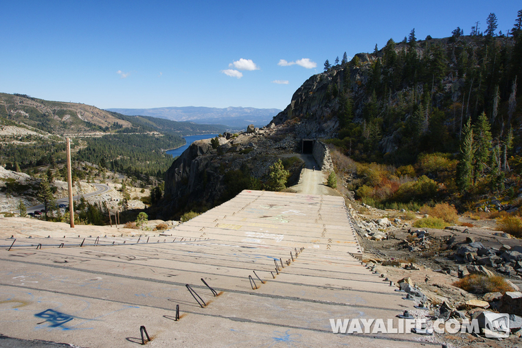
Standing on top of Tunnel #7 looking back at Tunnel #6...
View looking ahead at the Upper Chinese Wall built in 1867 by Chinese laborers and Tunnel #8 beyond...
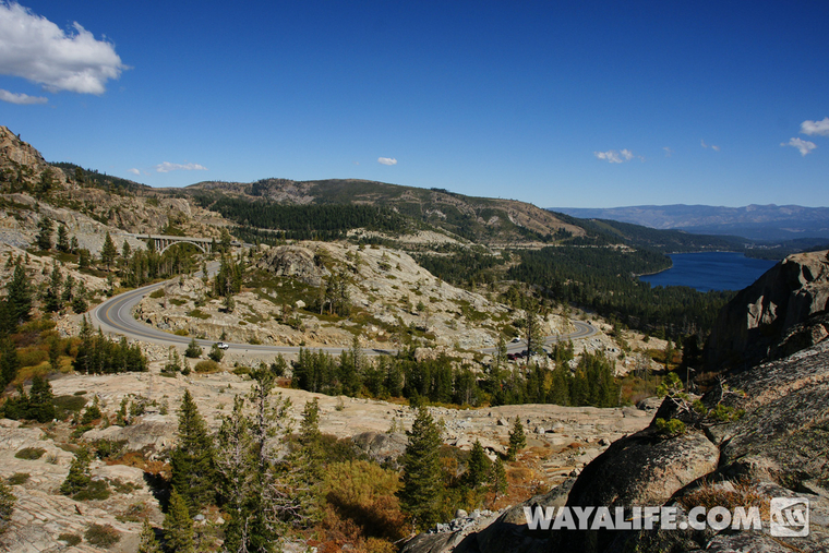
Looking back out toward the Donner Summit Rainbow bridge and Donner Lake beyond. If you look closely, you should also be able to just make out Moby...
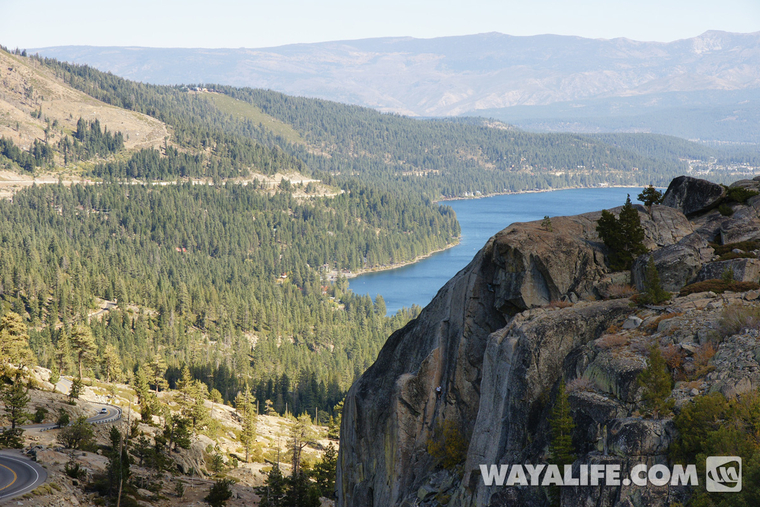
This area is a popular rock climbing destination and if you look real close, you can see a guy on the rock face...
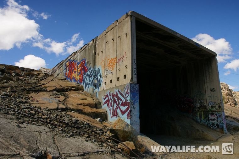
Another view of the concrete snowshed that makes up Tunnel #7...
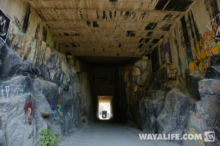
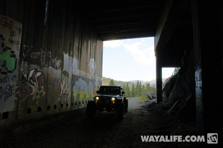
Making our way into Summit Tunnel...
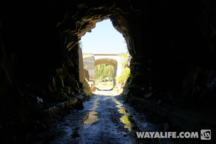
View looking back out...
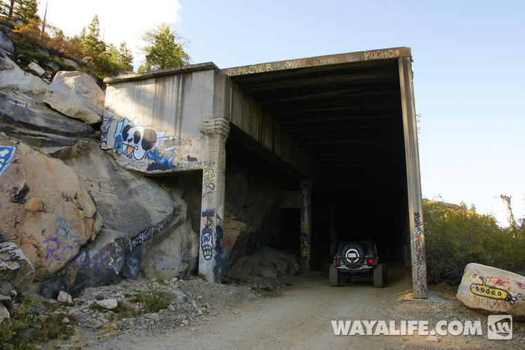
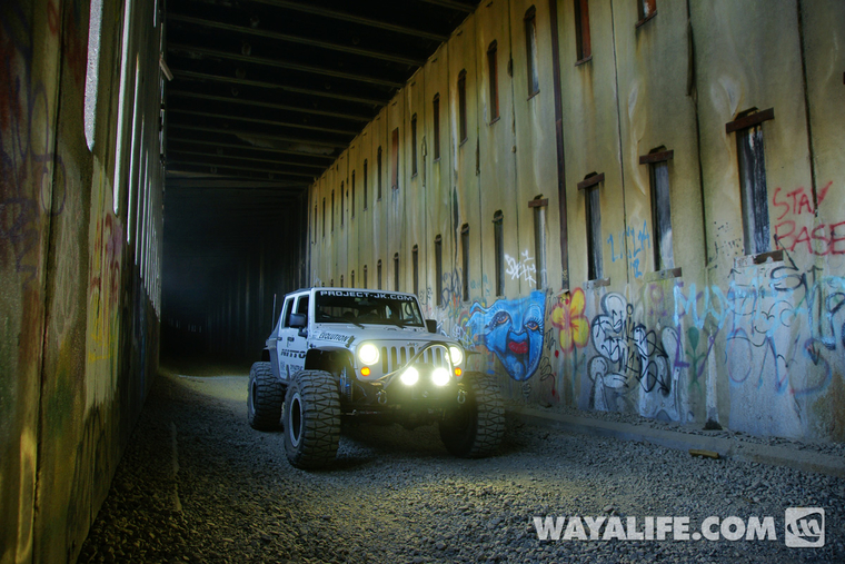
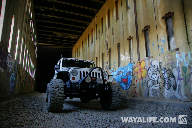
Heading down into the snowsheds...
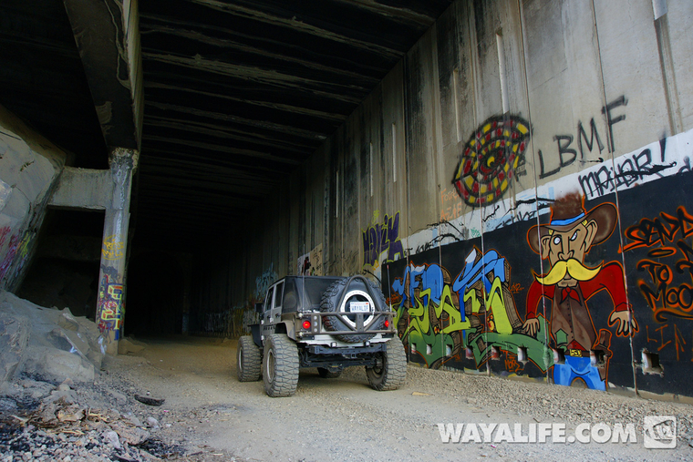
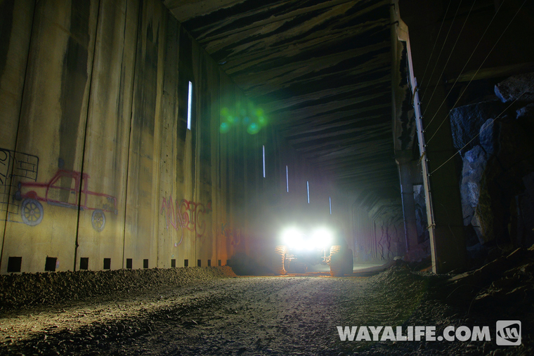
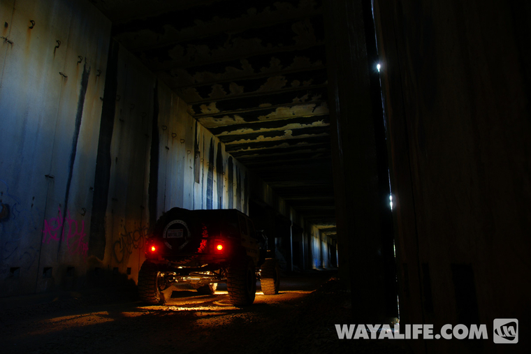
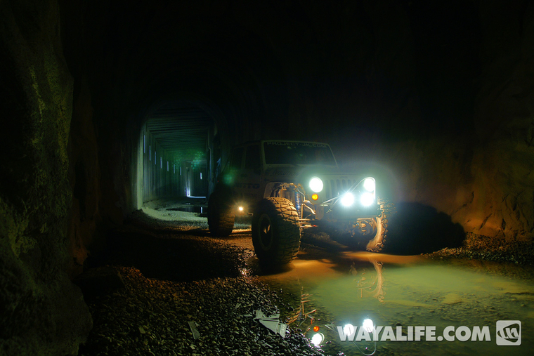
We drove all the way to the end of the accessible snowshed before taking more photos and this shot is actually of us going back into the last tunnel...
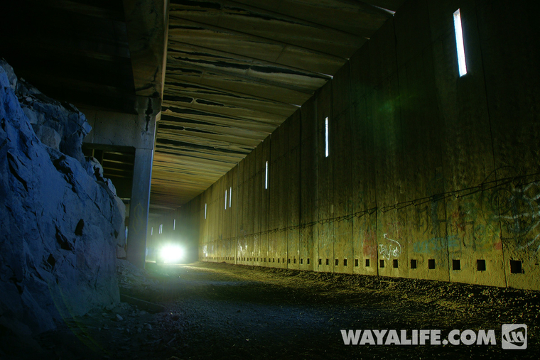
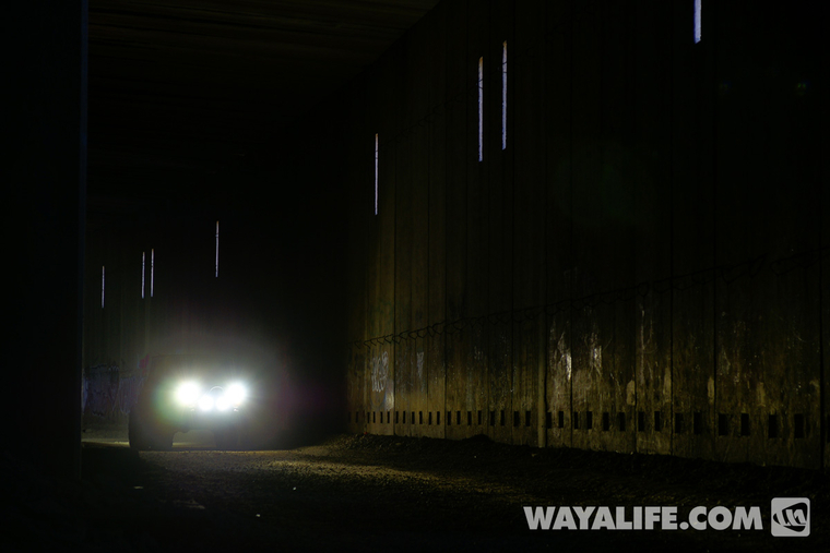
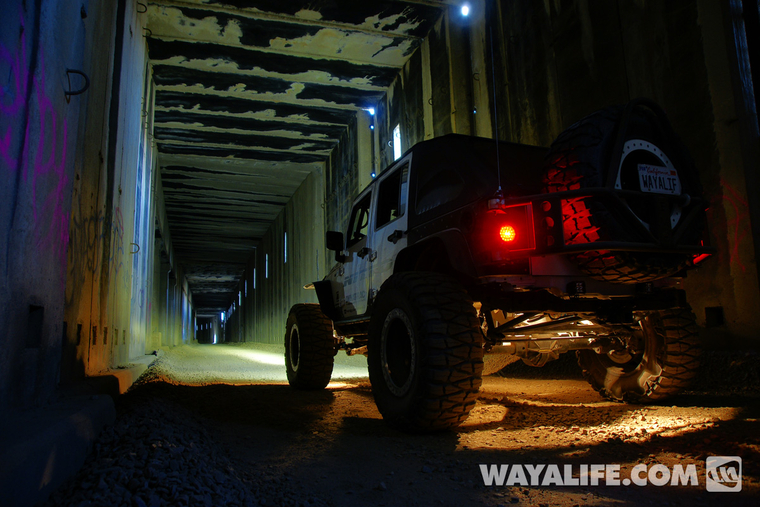
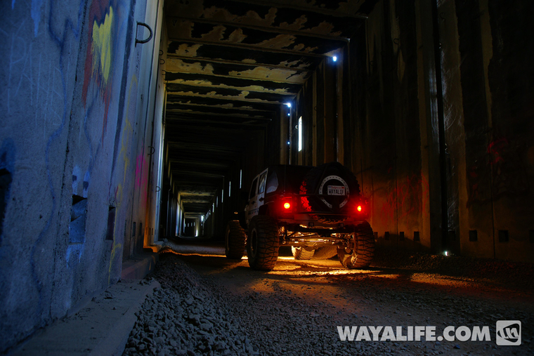
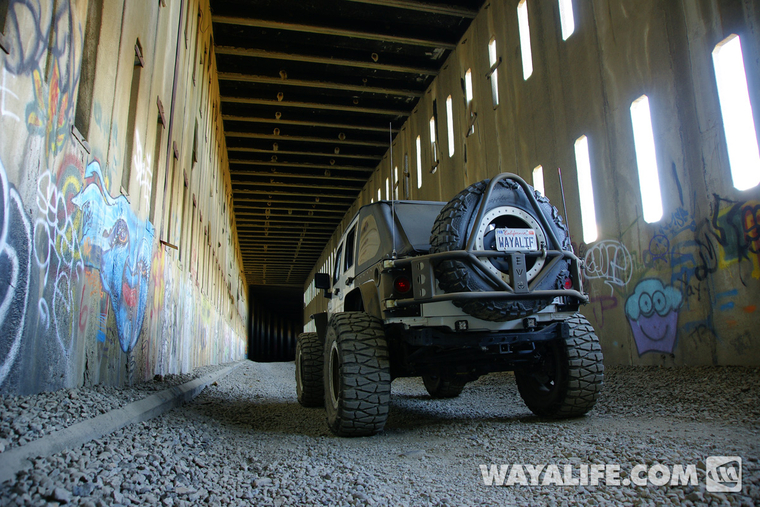
Moving further along with lights blazing ahead...
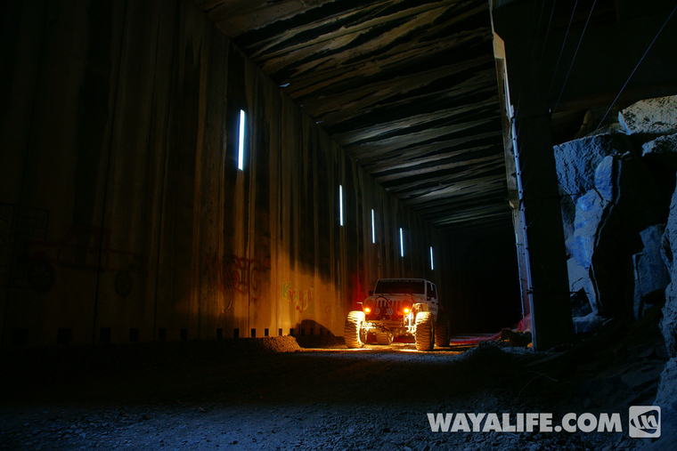
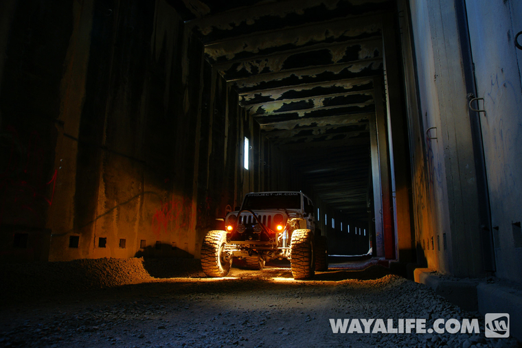
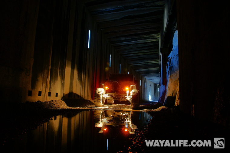
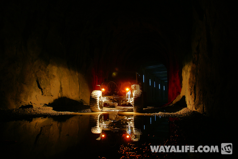
Another couple of shots deeper in with just the ambient light coming through the ventilation ports and rock lights on Moby...
Many sections of the tunnels are filled with shallow pools of water...
There are a lot more ventilation ports where the tunnels become enclosed sections of concrete snowsheds...
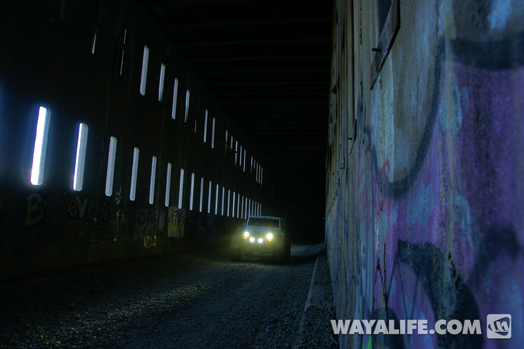
In these sections, lights really aren't needed...
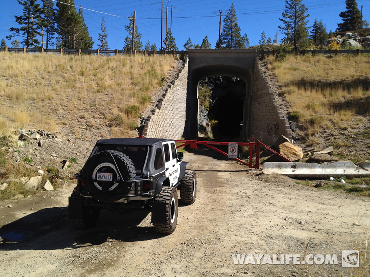
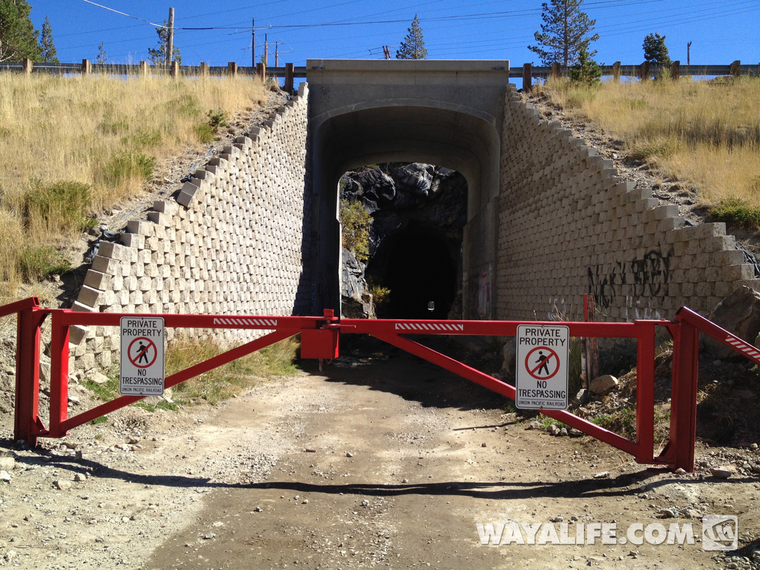
As mentioned, these awesome snowsheds are now closed to vehicular traffic. When we went back to the snowsheds in October, this is what we found...
For a while, you could get in from the back way but, from what I understand, that is being closed now too. You can still hike up to the Chinese Wall and gain un-restricted access to the snowsheds from there but, that's about it. I would still recommend them you check them out as they are a big part of California history and, really cool to see.
For 130 years, Central Pacific, Southern Pacific, Union Pacific, and AMTRAK ran trains though these snowsheds and was only abandoned and left to sit idle back in 1997. Up the summer of 2012, you could actually drive your Jeep through these amazing snowsheds but, for one reason or another, Union Pacific finally decided to construct a permanent barrier and block off vehicular access. Lucky for us, we were able to take Moby through one last time before they were closed and, these are some pics we took our final trip through. I hope you enjoy.
Before heading into the snowsheds, we took some time to explore the surrounding area just outside of them. Here you can see Moby crossing over the old Lincoln Highway Donner Summit Rainbow Bridge which was built in 1926...
View driving across this wonderful bridge, something that would not have been possible without the help of the Nevada County Board of Supervisors who helped provide $1.6 million to have it restore back in 1993...
Hiking up to the "Chinese Wall". This lower half stands 75 feet tall and was made almost entirely by hand...
Shot of an old underpass that was constructed back in 1914 and provided vehicular passage along the old Donner Pass Road before the completion of Highway 40 and the Donner Summit Bridge in 1926...
View from the other side - notice the Donner Summit Rainbow bridge in the distance...
View looking through the concrete Tunnel #7 with Tunnel #6, also known as the Summit Tunnel in the distance...
Standing on top of Tunnel #7 looking back at Tunnel #6...
View looking ahead at the Upper Chinese Wall built in 1867 by Chinese laborers and Tunnel #8 beyond...
Looking back out toward the Donner Summit Rainbow bridge and Donner Lake beyond. If you look closely, you should also be able to just make out Moby...
This area is a popular rock climbing destination and if you look real close, you can see a guy on the rock face...
Another view of the concrete snowshed that makes up Tunnel #7...
Making our way into Summit Tunnel...
View looking back out...
Heading down into the snowsheds...
We drove all the way to the end of the accessible snowshed before taking more photos and this shot is actually of us going back into the last tunnel...
Moving further along with lights blazing ahead...
Another couple of shots deeper in with just the ambient light coming through the ventilation ports and rock lights on Moby...
Many sections of the tunnels are filled with shallow pools of water...
There are a lot more ventilation ports where the tunnels become enclosed sections of concrete snowsheds...
In these sections, lights really aren't needed...
As mentioned, these awesome snowsheds are now closed to vehicular traffic. When we went back to the snowsheds in October, this is what we found...
For a while, you could get in from the back way but, from what I understand, that is being closed now too. You can still hike up to the Chinese Wall and gain un-restricted access to the snowsheds from there but, that's about it. I would still recommend them you check them out as they are a big part of California history and, really cool to see.