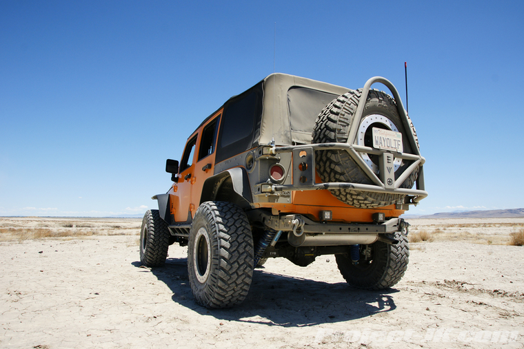
As many of you know, we spend our July's up in Tahoe and typically use our time up there to hike and wheel the extensive network of trails the area has to offer. And, while we still plan on doing that again this year, we decided to change things up a bit and utilize our northerly location to explore some of the Northern Nevada desert as well. To kick things off, our first expedition would be a 375 mile loop that started from South Lake Tahoe, dropped down to Carson City, headed east across the famous Pony Express Route, paid a visit to the historic Fort Churchill, explored the pre-historic Indian caves out at Grimes Point, made our way down the Rawhide Mining district and then circled around to Walker Lake before running out of time for the day. Here are some pics highlighting some of the things we saw. I hope you enjoy.
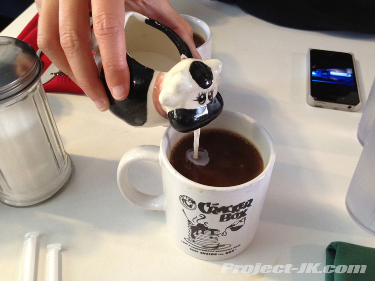
To start off our day, we made a stop for breakfast at the Cracker Box in Carson City. Is it just me or is there something just not right about a cow puking milk into your coffee...
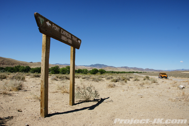
After heading east on Highway 50, the Lincoln Highway to some or the Loneliest Highway to others, we turned off onto dirt and started following the old Pony Express Route...
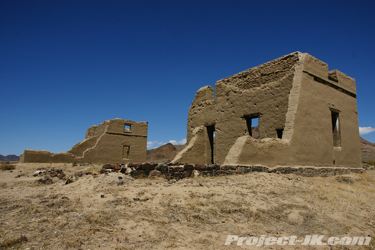
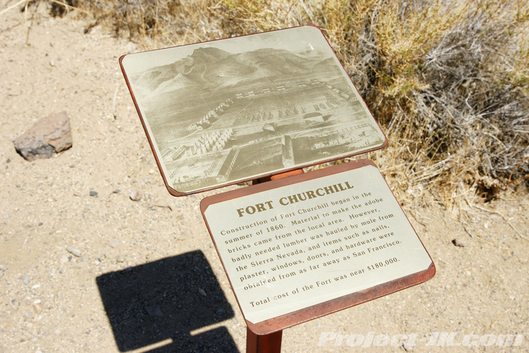
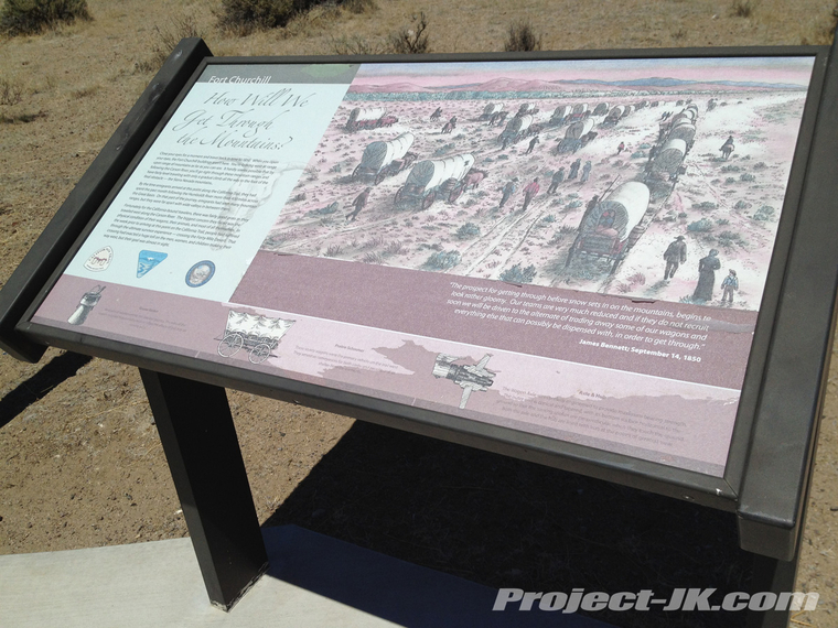
Our first official stop along the way was over at Fort Churchill, a military post that was established in 1860 to help fight the Paiute and Bannock Indians during the Pyramid Lake Wars...
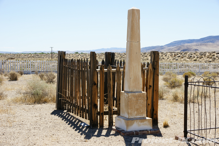
Before exploring the ruins of this old west frontier post, we decided to pay a visit to the cemetery first. All the soldiers who were buried here were relocated after the fort was decommissioned but, Samuel S. Buckland, a rancher who moved into the area at about the same time continued to use this cemetery and, he, his wife and various other people including several babies are still buried here today...
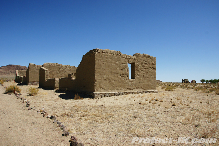
Walking amongst the Fort Churchill ruins - these were some of the old barracks...
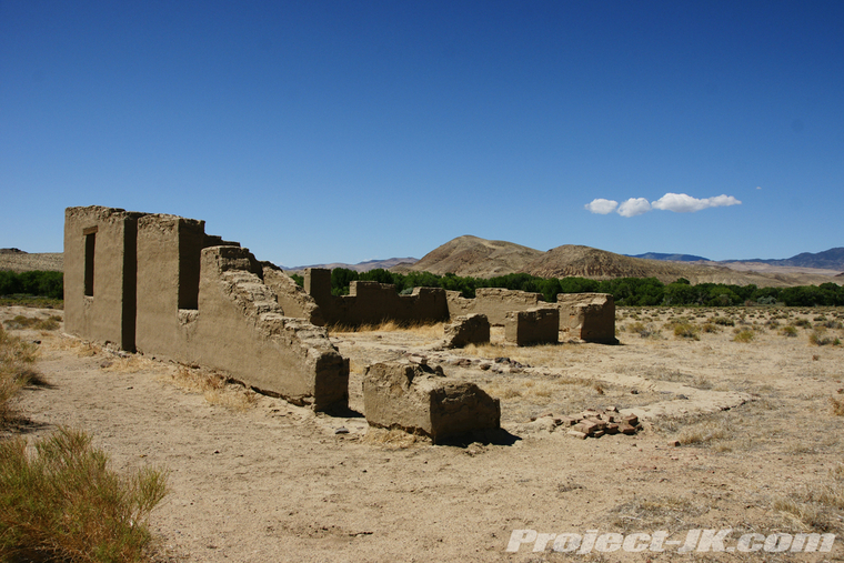
One of several mess halls...
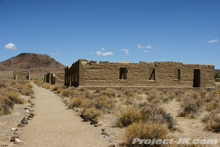
Storage facilities...
The infirmary...
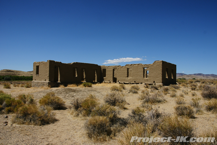
The officers quarters - said to be some of the finest homes in general that you could live in during the day...
What the Fort used to look like...
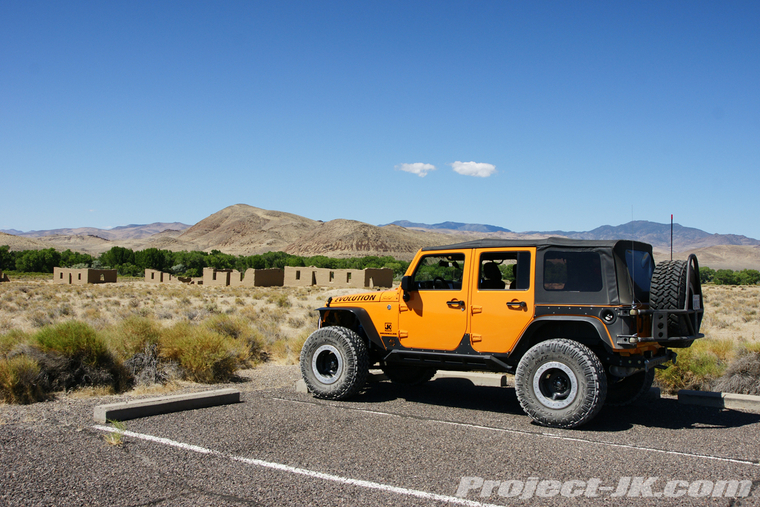
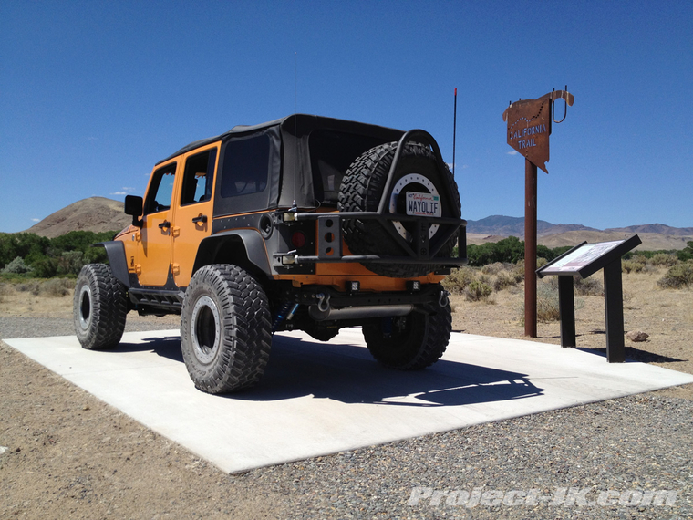
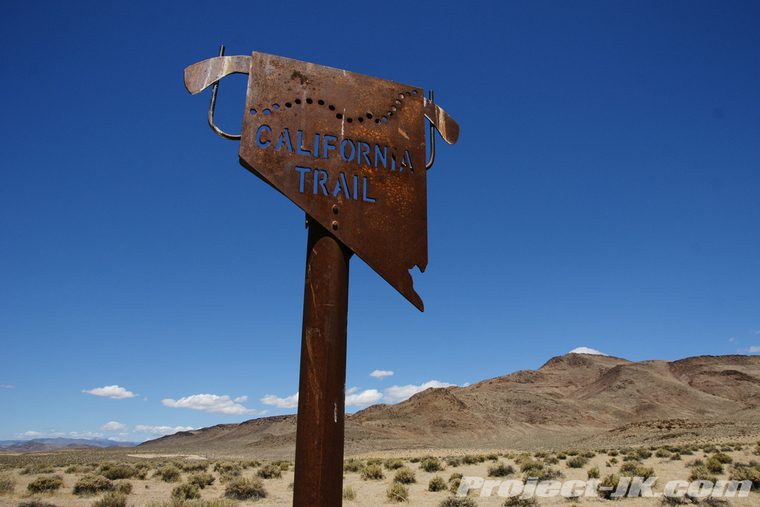
Taking a spin around the fort, we stopped at a monument dedicated to the California Trail. It really is hard to imagine how people spent months to travel across the Great Basin Desert in covered wagons especially when it can now be done in a covered wagon like this in less than a day...
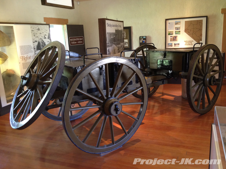
Shot inside the visitor center - Before there was a Jeep, there was this war wagon complete with EVO spec wagon wheel carrier...
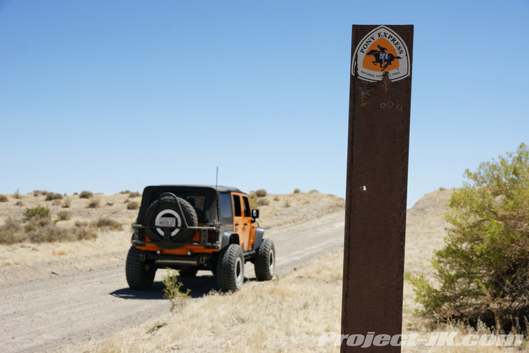
Time to move along - It's hard to believe that for 19 short months starting from April 3, 1860, 80 riders and 400 horses carried news and mail along in this harsh trail from St. Joseph, Missouri to Sacramento, California and in just 10 days (as opposed to 3 weeks by stagecoach). Back then, riders were required to weigh no more than 120 lbs. and were equipped with only a knife, horn, revolver and some jerky. Back in the day, ads seeking riders noted that they were looking for "young, skinny, wiry fellows, not over 18... orphans preferred." While riders were required to cover 100-125 miles a day, one rider by the name of William F. "Buffalo Bill" Cody is said to have ridden a total of 384 continuous miles. And, after having driven along this trail in our modern built up Jeep, I must say that I utterly amazed that these kids were able to do what they did...
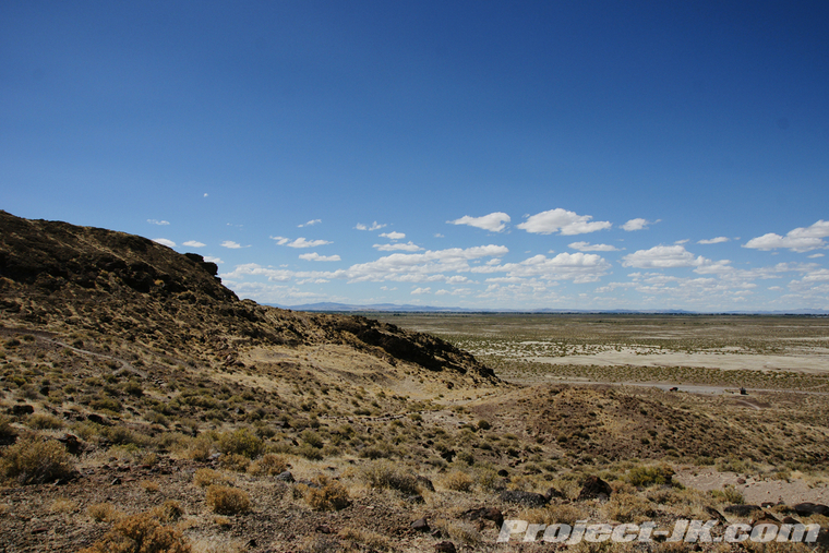
The landscape becoming more and more barren...
If you look real close, you can just make out Rubicat in the distance. 16,000 years ago, she would have been sitting more than 100 feet below the waters of the enormous, pre-historic Lake Lahontan...
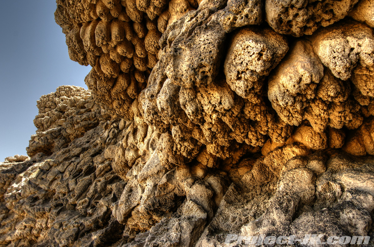
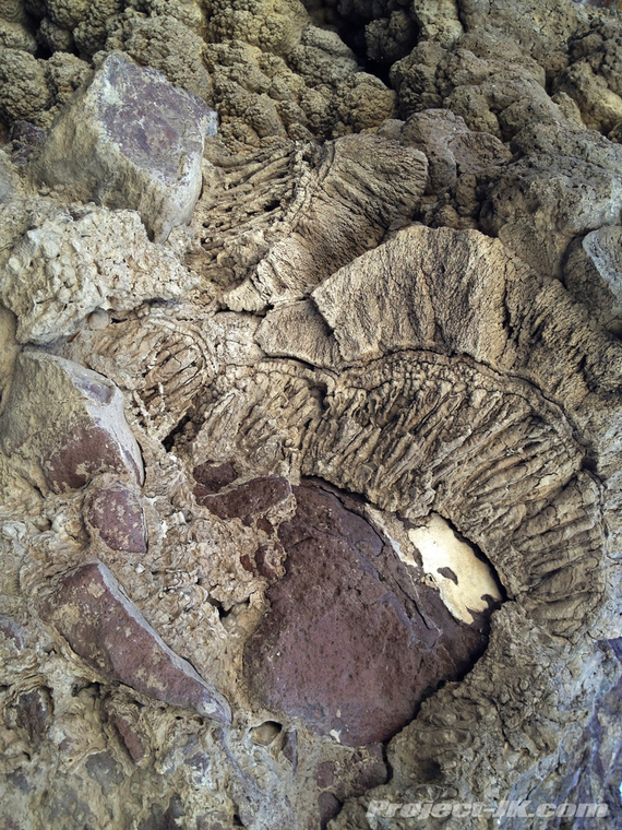
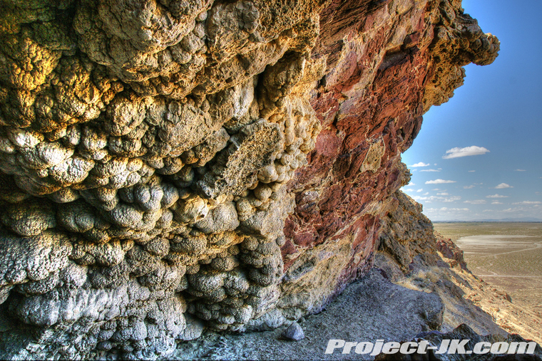
Filled with ice melt from the last ice age, Lake Lahontan covered a better part of Western Nevada and, out in an area now known as Grimes Point, underwater springs feeding into it created these amazing, organically shaped tufa formations...
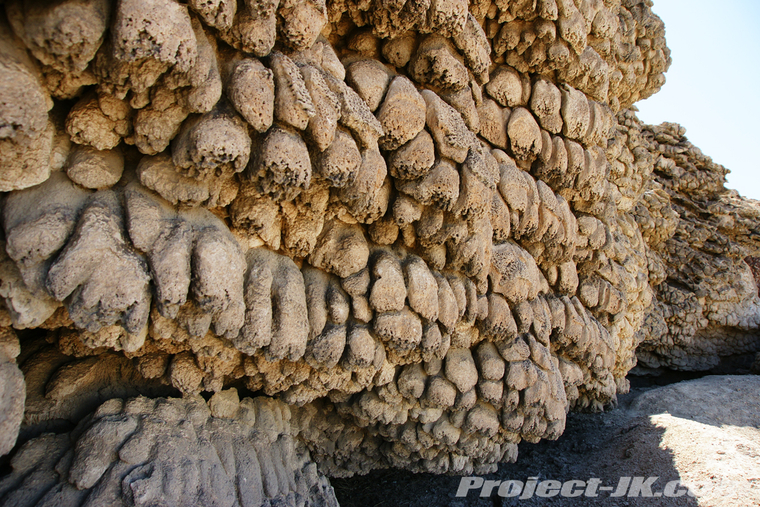
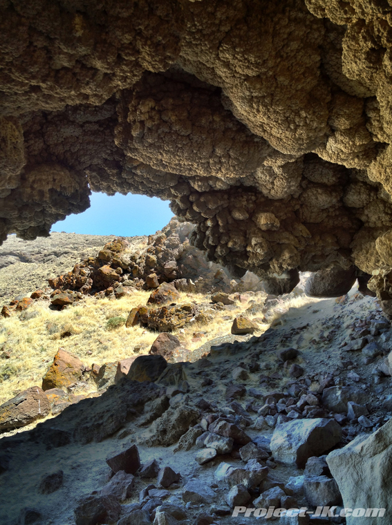
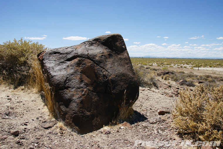
Approximately 10,000 years ago, the level of Lake Lahontan began to lower enough to expose these tufa encrusted cliffs revealing caves that ancient people used for shelter and storage - view looking out of a larger one in the area...
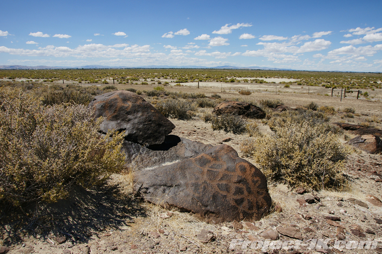
Literally hundreds of rocks in this area are covers with intricate petroglyphs...
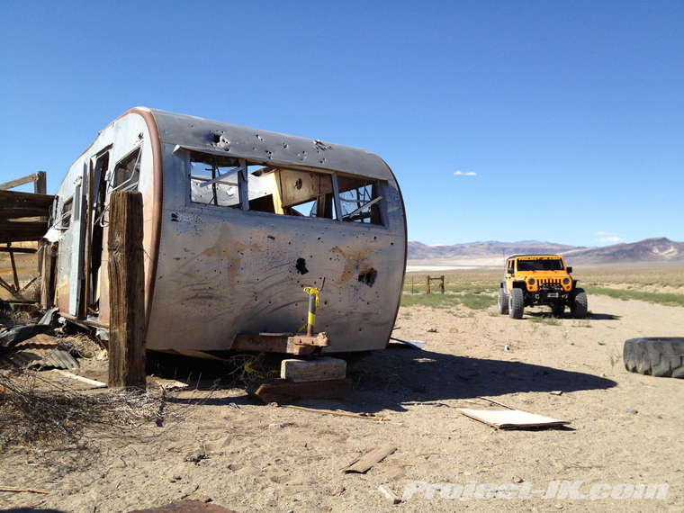
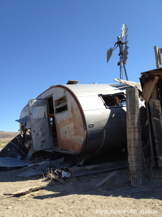
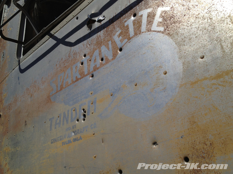
Moving along, we turned off the Pony Express route and headed south down into the Rawhide Mining District. Our first stop along the way was over at the old Wightman Well. Unfortunately, it looked like the yahoos had gotten to it with their guns and tore it all up. It's really is unfortunate too as I had seen recent photos of this trailer and it was in much better condition...
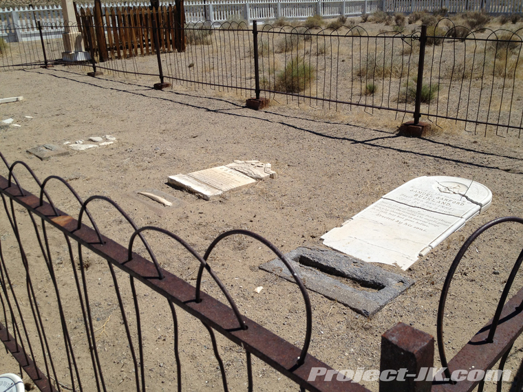
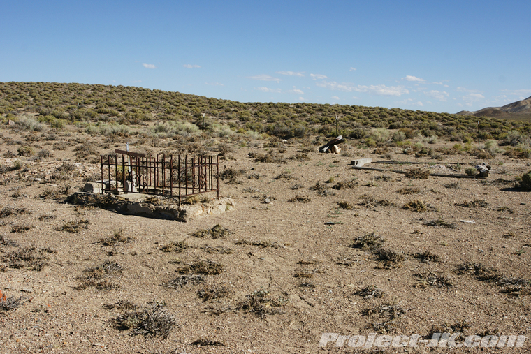
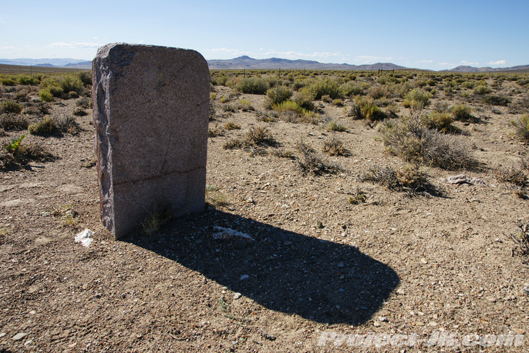
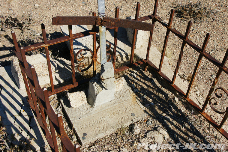
Between 1907 and 1908, the town of Rawhide had as many as 10,000 residents and among other things, had 40 saloons and a red light district called the Stingaree Gulch that extended a quarter mile long. Today, this small cemetery is all that remains...
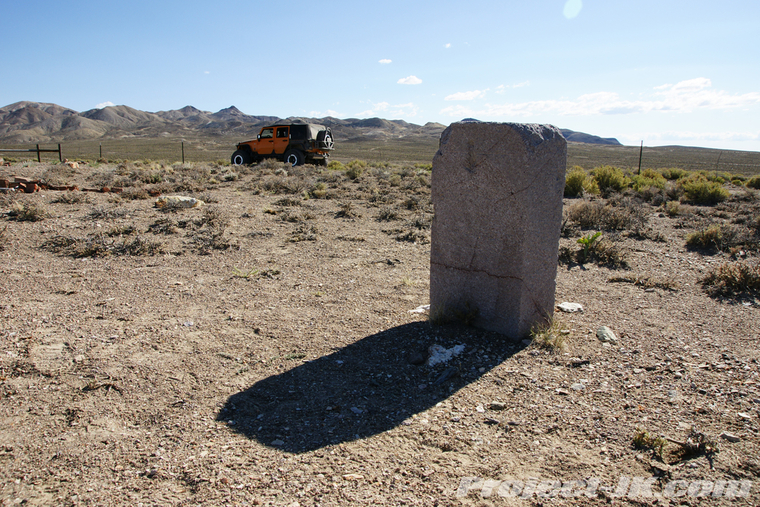
One of two headstones that remain belong to Bruce Evans. In this lighting, it is difficult to read but, it states he was born in 1850 and died in 1914...
The other grave marker that can still be read belongs to the one year old child, Raymond Ryus Rule...
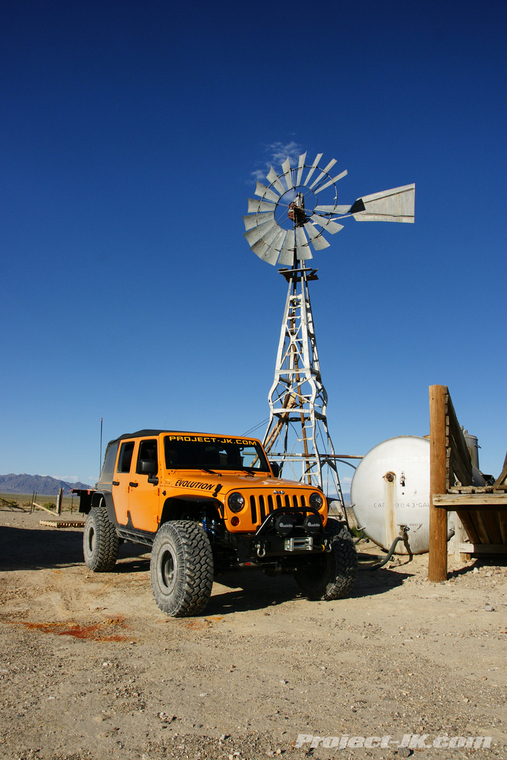
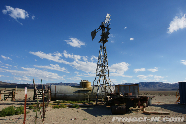
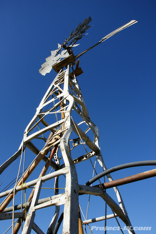
Still further south and more to the east, we stopped to check out the uniquely made Car Frame Windmill - a name appropriately given being that the entire structure is literally made out of old car frames...
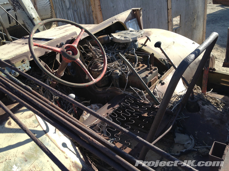
Cool old truck attached to the windmill...
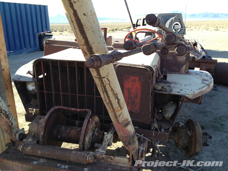
If you can believe it, the steering still worked on this thing...
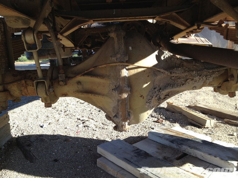
Check out this crazy differential that's bolted together in the middle...
After a really long drive down and around to Hawthorne, we found ourselves running out of daylight and decided to put off the other destinations on our to do list for another day. So, with the sun setting, we drove down to the shores of Walker Lake (one of two remaining bodies of water from the ancient Lake Lahontan) and took this parting shot...
If you would like to see all the pics we took on this epic expedition, simply click on the link below:
Northern Nevada Expedition Photo Gallery
Until next time
To start off our day, we made a stop for breakfast at the Cracker Box in Carson City. Is it just me or is there something just not right about a cow puking milk into your coffee...
After heading east on Highway 50, the Lincoln Highway to some or the Loneliest Highway to others, we turned off onto dirt and started following the old Pony Express Route...
Our first official stop along the way was over at Fort Churchill, a military post that was established in 1860 to help fight the Paiute and Bannock Indians during the Pyramid Lake Wars...
Before exploring the ruins of this old west frontier post, we decided to pay a visit to the cemetery first. All the soldiers who were buried here were relocated after the fort was decommissioned but, Samuel S. Buckland, a rancher who moved into the area at about the same time continued to use this cemetery and, he, his wife and various other people including several babies are still buried here today...
Walking amongst the Fort Churchill ruins - these were some of the old barracks...
One of several mess halls...
Storage facilities...
The infirmary...
The officers quarters - said to be some of the finest homes in general that you could live in during the day...
What the Fort used to look like...
Taking a spin around the fort, we stopped at a monument dedicated to the California Trail. It really is hard to imagine how people spent months to travel across the Great Basin Desert in covered wagons especially when it can now be done in a covered wagon like this in less than a day...
Shot inside the visitor center - Before there was a Jeep, there was this war wagon complete with EVO spec wagon wheel carrier...
Time to move along - It's hard to believe that for 19 short months starting from April 3, 1860, 80 riders and 400 horses carried news and mail along in this harsh trail from St. Joseph, Missouri to Sacramento, California and in just 10 days (as opposed to 3 weeks by stagecoach). Back then, riders were required to weigh no more than 120 lbs. and were equipped with only a knife, horn, revolver and some jerky. Back in the day, ads seeking riders noted that they were looking for "young, skinny, wiry fellows, not over 18... orphans preferred." While riders were required to cover 100-125 miles a day, one rider by the name of William F. "Buffalo Bill" Cody is said to have ridden a total of 384 continuous miles. And, after having driven along this trail in our modern built up Jeep, I must say that I utterly amazed that these kids were able to do what they did...
The landscape becoming more and more barren...
If you look real close, you can just make out Rubicat in the distance. 16,000 years ago, she would have been sitting more than 100 feet below the waters of the enormous, pre-historic Lake Lahontan...
Filled with ice melt from the last ice age, Lake Lahontan covered a better part of Western Nevada and, out in an area now known as Grimes Point, underwater springs feeding into it created these amazing, organically shaped tufa formations...
Approximately 10,000 years ago, the level of Lake Lahontan began to lower enough to expose these tufa encrusted cliffs revealing caves that ancient people used for shelter and storage - view looking out of a larger one in the area...
Literally hundreds of rocks in this area are covers with intricate petroglyphs...
Moving along, we turned off the Pony Express route and headed south down into the Rawhide Mining District. Our first stop along the way was over at the old Wightman Well. Unfortunately, it looked like the yahoos had gotten to it with their guns and tore it all up. It's really is unfortunate too as I had seen recent photos of this trailer and it was in much better condition...
Between 1907 and 1908, the town of Rawhide had as many as 10,000 residents and among other things, had 40 saloons and a red light district called the Stingaree Gulch that extended a quarter mile long. Today, this small cemetery is all that remains...
One of two headstones that remain belong to Bruce Evans. In this lighting, it is difficult to read but, it states he was born in 1850 and died in 1914...
The other grave marker that can still be read belongs to the one year old child, Raymond Ryus Rule...
Still further south and more to the east, we stopped to check out the uniquely made Car Frame Windmill - a name appropriately given being that the entire structure is literally made out of old car frames...
Cool old truck attached to the windmill...
If you can believe it, the steering still worked on this thing...
Check out this crazy differential that's bolted together in the middle...
After a really long drive down and around to Hawthorne, we found ourselves running out of daylight and decided to put off the other destinations on our to do list for another day. So, with the sun setting, we drove down to the shores of Walker Lake (one of two remaining bodies of water from the ancient Lake Lahontan) and took this parting shot...
If you would like to see all the pics we took on this epic expedition, simply click on the link below:
Northern Nevada Expedition Photo Gallery
Until next time