You are using an out of date browser. It may not display this or other websites correctly.
You should upgrade or use an alternative browser.
You should upgrade or use an alternative browser.
Jeeping Across America - Western Follies
- Thread starter NFRs2000NYC
- Start date
Andy5160
Hooked
This is good stuff - looking forward to more!
Are you doing something similar any time soon buddy boy :yup::yup:
NFRs2000NYC
Caught the Bug
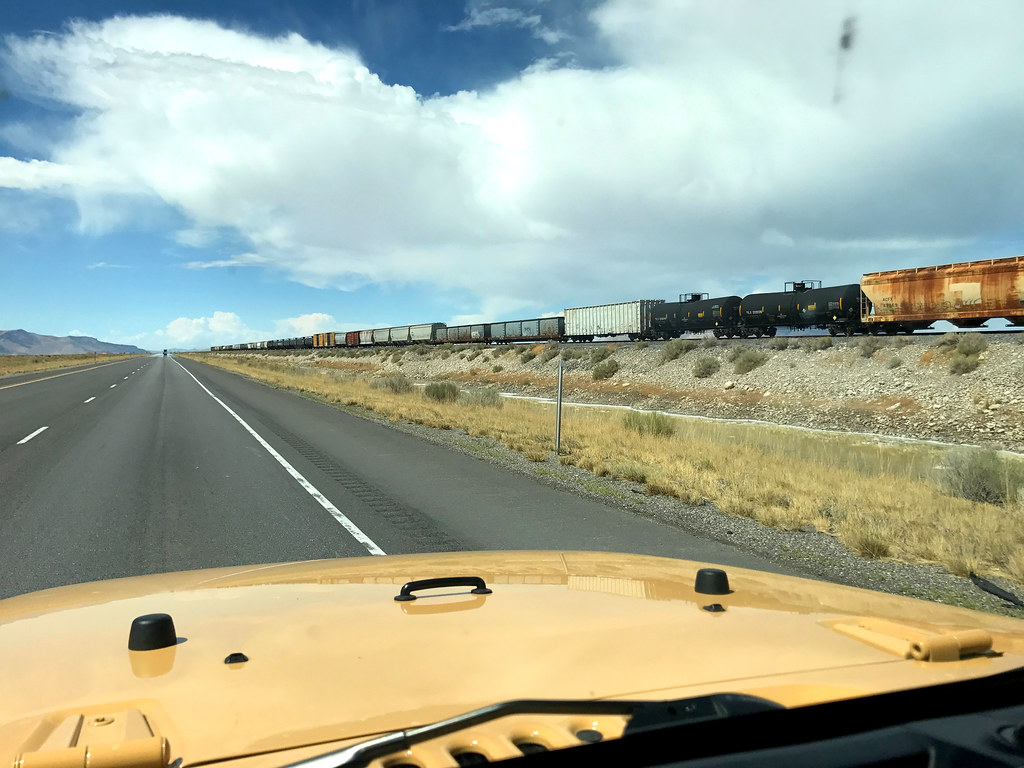
So the first stop was in the middle of nowhere....and driving there was a bit of a pain down more monotonous roads...
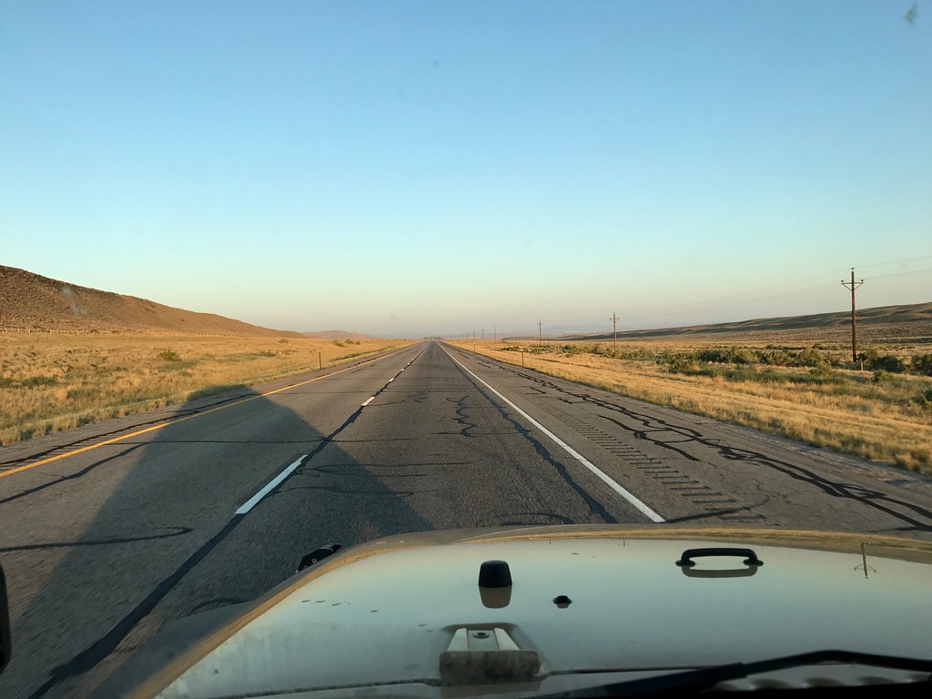
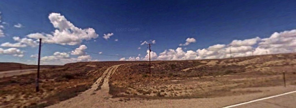
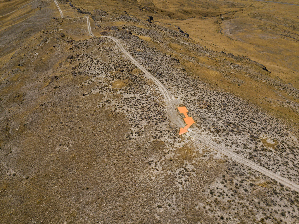
When I arrived at the turnoff, there was a dusty turnoff that seeme to lead into the hills
(image from google maps street view)
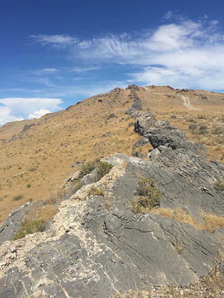
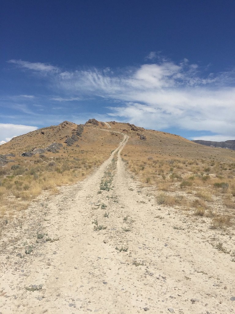
There were two cars at the intersection on the road that I was on, and they watched in utter bewilderment why a vehicle from NJ is crawling onto this weird dusty track. The surface was sandy and loose, and very hollow, almost as if underneath the sand there were pockets of air that collapsed as I drove over them, so I needed 4WD in this section. The road seemed to cross over itself a bunch of times almost like a maze, so I had to resort pulling out my GPS to see satellite images so I can trace my "steps" to the destination. Finally after a few more minutes of driving/looking around, we spot it in the distance.
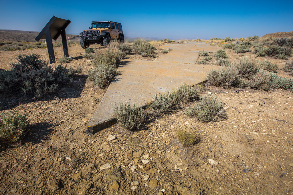
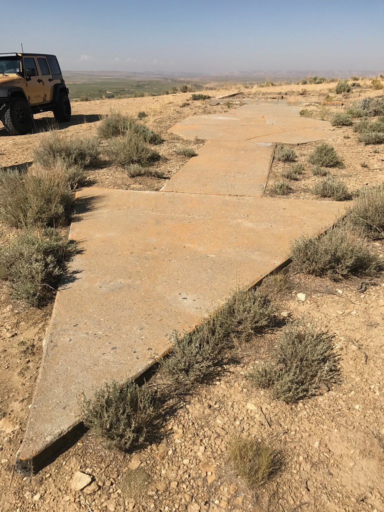
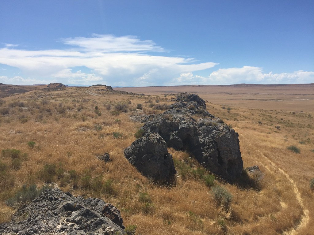
Some of you may recognize these from the awesome thread Eddie started and got half the forum hooked looking for these, but for those just finding out about these concrete arrows, here's a brief cliffnote version of what they are. Long before GPS and modern pilot instrumentation, airmail pilots had to rely on visual ground "beacons" to help them navigate their way around the nation. Deployed in 1924, these beacons helped mail get delivered 2 days faster by allowing pilots to continue flying at night, as they no longer had to land and load the mail onto rail cars, and at it's peak, there were 285 of these beacons across the nation. If you look closely, in one of the photos you will notice a "box" outline on the ground where something once stood. In this box stood a tower that would light up the arrow so the pilots could see it clearly at night. Most of these beacons on the east coast have been destroyed, a few pieces remain on private property, but out west, many remain waiting to be found like a classic western treasure hunt. This particular beacon indicated a heading for the Chicago to San Francisco route.
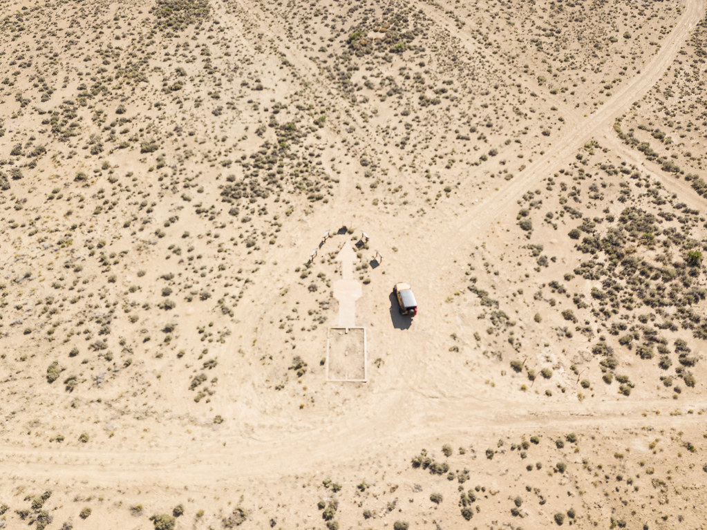
Drone error/lesson 1...always make sure you have autofocus turned ON. Unfortunately, the photos (like the single one above) and the video from this location was all blurry, as I had manual focus turned on for some reason (by accident Im sure) and as a result, the video, and the pics of me and the wife taken from the air are worthless. You have no idea how angry I was when I got to the hotel. I also later learned that you can playback the video from the drone to the phone wirelessly to double check that the video/photos are on point. "Expensive" lesson to learn, as it cost me time and a priceless photo. Really a shame, but what can you do.
When I arrived at the turnoff, there was a dusty turnoff that seeme to lead into the hills
(image from google maps street view)
There were two cars at the intersection on the road that I was on, and they watched in utter bewilderment why a vehicle from NJ is crawling onto this weird dusty track. The surface was sandy and loose, and very hollow, almost as if underneath the sand there were pockets of air that collapsed as I drove over them, so I needed 4WD in this section. The road seemed to cross over itself a bunch of times almost like a maze, so I had to resort pulling out my GPS to see satellite images so I can trace my "steps" to the destination. Finally after a few more minutes of driving/looking around, we spot it in the distance.
Some of you may recognize these from the awesome thread Eddie started and got half the forum hooked looking for these, but for those just finding out about these concrete arrows, here's a brief cliffnote version of what they are. Long before GPS and modern pilot instrumentation, airmail pilots had to rely on visual ground "beacons" to help them navigate their way around the nation. Deployed in 1924, these beacons helped mail get delivered 2 days faster by allowing pilots to continue flying at night, as they no longer had to land and load the mail onto rail cars, and at it's peak, there were 285 of these beacons across the nation. If you look closely, in one of the photos you will notice a "box" outline on the ground where something once stood. In this box stood a tower that would light up the arrow so the pilots could see it clearly at night. Most of these beacons on the east coast have been destroyed, a few pieces remain on private property, but out west, many remain waiting to be found like a classic western treasure hunt. This particular beacon indicated a heading for the Chicago to San Francisco route.
Drone error/lesson 1...always make sure you have autofocus turned ON. Unfortunately, the photos (like the single one above) and the video from this location was all blurry, as I had manual focus turned on for some reason (by accident Im sure) and as a result, the video, and the pics of me and the wife taken from the air are worthless. You have no idea how angry I was when I got to the hotel. I also later learned that you can playback the video from the drone to the phone wirelessly to double check that the video/photos are on point. "Expensive" lesson to learn, as it cost me time and a priceless photo. Really a shame, but what can you do.
BamBamDeer
New member
I've been following along, I'm enjoying your trip. Thanks for sharing, will be looking for more.
Sent from my SAMSUNG-SM-G900A using WAYALIFE mobile app
Sent from my SAMSUNG-SM-G900A using WAYALIFE mobile app
Riverinechop
Member
Cool pics and opening video. Looking forward to seeing more.
Sent from my SAMSUNG-SM-G935A using WAYALIFE mobile app
Sent from my SAMSUNG-SM-G935A using WAYALIFE mobile app
NFRs2000NYC
Caught the Bug
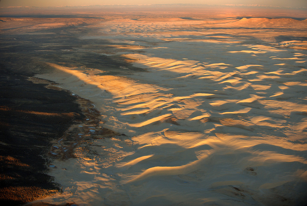
So after this quick stop, we hit the road to our next destination. The destination is Killpecker Sand Dunes, the second largest active dune field in the world, as well as being 1 of only 7 singing dune fields in the world. For those unfamiliar with the concept of singing sand, check out Eddie's awesome thread/video on the subject....
https://wayalife.com/showthread.php/1211-The-Singing-Sand-Dunes
So after some slightly more interesting driving,
We arrived at the dirt turnoff.
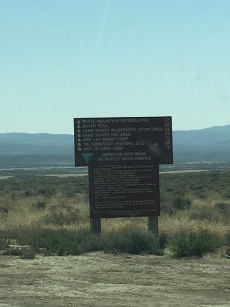
Before hitting the dunes, I wanted to check out Boar's Tusk, a rock formation that rises up in the middle of nowhere, is essentially a volcanic plug. So we start our drive, which is actually quite long, and realize OMG, this entire road is corrugation hell. If you have never driven on a corrugated road, it's an extremely unpleasant experience. If feels like Thor has picked up your vehicle with you in it, and is shaking it like a salt shaker, and the more carefully you drive, it seems the worst it is. After about a mile of it, we couldn't take it anymore. So we pulled over for a little chat....so I decided I would try something else, instead of driving slowly, Im going to hit the pedal to the metal and go fast Ricky Bobby, hoping that my tires wouldn't have the time to fall into the dips and the ride would smooth out. I also knew that this puts A LOT of strain on the shocks (I run Rancho 9000s), but regardless, driving slowly was not an option, especially for 28 miles. In the trailer you see me bombing down that road, and wouldn't you know it, the ride was as smooth as butter. We did pass a few rental "SUVs" that were pulled over with what looked like smoking brakes, but it wasn't the brakes that were smoking, it was their shock fluid. Another vehicle had 2 puddles near the back tires, the shocks puked up all their fluid. I felt mine at the end of the ride and while they were fairly warm, they were not blown or had any damage.
After a few miles, we arrive at the turnoff for boars tusk. I make it about 100 feet before realizing Im driving in pretty caked mud..dry at the surface but sopping wet underneath...it must have rained here very recently, and the conditions made the road impassable. To add insult to injury, before my trip, I ordered a set of MAXTRAX to help if I got stuck in the sand or mud, but UPS lost the shipment, and it was too late to order another set before my Sunday departure. To make it not a total loss, I said, ok, I can't get there with the Jeep, let me at least get some drone footage. So I bust out the mavic, and let it loose. I do a nice 15 flight, and bring it back...only to realize...
Drone Error/Lesson #2.....always make sure you hit record before you set out on your flight. I was so worried about getting nice and smooth footage, that I forgot to hit record, so all that flight was for nothing. However, later that night when I got to my hotel, I realized that everything I would have recorded was out of focus anyway (same day as the concrete arrow) but I didn't know that at the time, so you can image my frustration. At this point, the wife was starting to get annoyed, as we've spent a big part of the day and decent detour out of "the way" to get here, without a payoff. This is boar's tusk (not my photo)
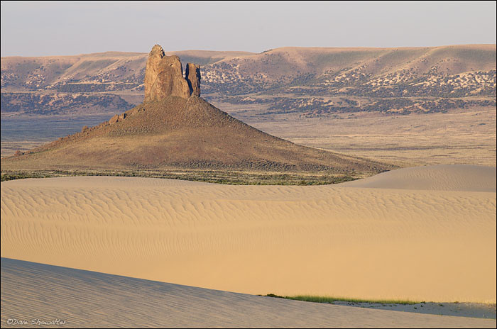
I knew I didn't have much time left in terms of wife's tolerance, so I took off towards the dunes...which again, were underwhelming from a get out and look perspective.
They were not very large and "dune looking" from the ground level, and because we were absolutely alone, and I had no method of extraction should I get stuck in the sand, I made a safety call NOT to go out onto the dunes. I guess I will have to save my dune exploration for the Dumont dunes on something when I venture out to Nevada. These dunes however, were wide, and the sand went on as far as the eye can see.
Feeling a bit deflated and a bit frustrated, I pulled a hoonigan and bombed my way out of those 28 miles, reaching speeds of nearly 75mph.....and as a seasoned tail of the dragon driver, it must say it was the most exciting piece of driving I've ever done. Going fast on dirt is 1000X more exciting that doing it on concrete.
After this "misadventure" we grabbed a quick lunch and once again hit the open road onwards....
https://wayalife.com/showthread.php/1211-The-Singing-Sand-Dunes
So after some slightly more interesting driving,
We arrived at the dirt turnoff.
Before hitting the dunes, I wanted to check out Boar's Tusk, a rock formation that rises up in the middle of nowhere, is essentially a volcanic plug. So we start our drive, which is actually quite long, and realize OMG, this entire road is corrugation hell. If you have never driven on a corrugated road, it's an extremely unpleasant experience. If feels like Thor has picked up your vehicle with you in it, and is shaking it like a salt shaker, and the more carefully you drive, it seems the worst it is. After about a mile of it, we couldn't take it anymore. So we pulled over for a little chat....so I decided I would try something else, instead of driving slowly, Im going to hit the pedal to the metal and go fast Ricky Bobby, hoping that my tires wouldn't have the time to fall into the dips and the ride would smooth out. I also knew that this puts A LOT of strain on the shocks (I run Rancho 9000s), but regardless, driving slowly was not an option, especially for 28 miles. In the trailer you see me bombing down that road, and wouldn't you know it, the ride was as smooth as butter. We did pass a few rental "SUVs" that were pulled over with what looked like smoking brakes, but it wasn't the brakes that were smoking, it was their shock fluid. Another vehicle had 2 puddles near the back tires, the shocks puked up all their fluid. I felt mine at the end of the ride and while they were fairly warm, they were not blown or had any damage.
After a few miles, we arrive at the turnoff for boars tusk. I make it about 100 feet before realizing Im driving in pretty caked mud..dry at the surface but sopping wet underneath...it must have rained here very recently, and the conditions made the road impassable. To add insult to injury, before my trip, I ordered a set of MAXTRAX to help if I got stuck in the sand or mud, but UPS lost the shipment, and it was too late to order another set before my Sunday departure. To make it not a total loss, I said, ok, I can't get there with the Jeep, let me at least get some drone footage. So I bust out the mavic, and let it loose. I do a nice 15 flight, and bring it back...only to realize...
Drone Error/Lesson #2.....always make sure you hit record before you set out on your flight. I was so worried about getting nice and smooth footage, that I forgot to hit record, so all that flight was for nothing. However, later that night when I got to my hotel, I realized that everything I would have recorded was out of focus anyway (same day as the concrete arrow) but I didn't know that at the time, so you can image my frustration. At this point, the wife was starting to get annoyed, as we've spent a big part of the day and decent detour out of "the way" to get here, without a payoff. This is boar's tusk (not my photo)
I knew I didn't have much time left in terms of wife's tolerance, so I took off towards the dunes...which again, were underwhelming from a get out and look perspective.
They were not very large and "dune looking" from the ground level, and because we were absolutely alone, and I had no method of extraction should I get stuck in the sand, I made a safety call NOT to go out onto the dunes. I guess I will have to save my dune exploration for the Dumont dunes on something when I venture out to Nevada. These dunes however, were wide, and the sand went on as far as the eye can see.
Feeling a bit deflated and a bit frustrated, I pulled a hoonigan and bombed my way out of those 28 miles, reaching speeds of nearly 75mph.....and as a seasoned tail of the dragon driver, it must say it was the most exciting piece of driving I've ever done. Going fast on dirt is 1000X more exciting that doing it on concrete.
After this "misadventure" we grabbed a quick lunch and once again hit the open road onwards....
BananaJeep
Caught the Bug
A bad day on the trail is still better than a good day at work :thumb:
Looks like a great trip so far! Can't wait to see the rest.
Looks like a great trip so far! Can't wait to see the rest.
NFRs2000NYC
Caught the Bug
NFRs2000NYC
Caught the Bug
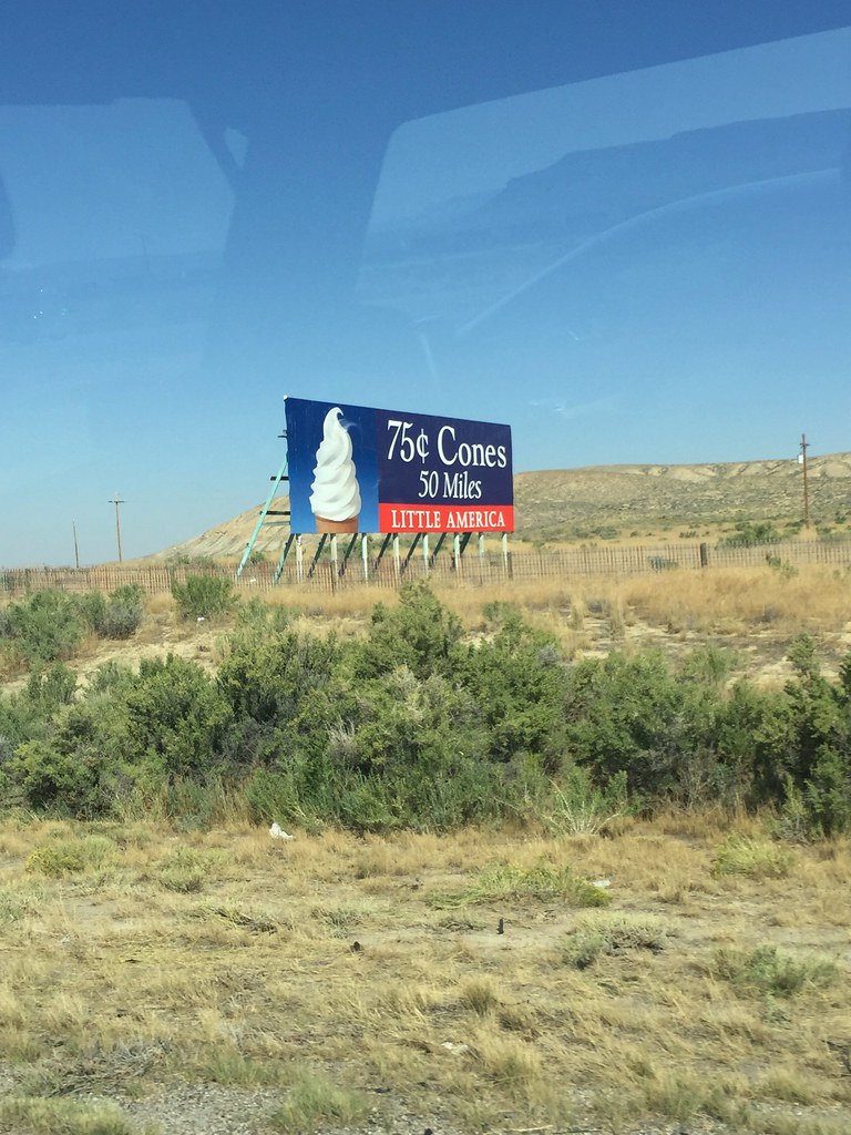
So on the way to getting some ice cream cones...
We decided to pull over for a bite to eat, and have a little talk. We were approximately 590 miles away from Jackson at this point, and learning my lesson from our Hawaii trip (going to volcano national park during a time where the winds were blowing the wrong way and 95% of the park was closed) as well as my last trip where I was locked out of the shafer switchbacks, I decided to look up current conditions in the big parks. Now I should point out, a good number of locals advised me to stay away from these parks in August, as it is PACKED with tourists, on 1 lane roads, constant traffic jams (talking 2-3 hours+) and just generally a miserable time...so much so, that locals never go to these parks in the summer. I looked up the current conditions and Im reading there are fires throughout, and they are closing this entrance and that entrance, etc....learning my less from prior trips, we made the decision to scrap our northern route, save the Wyoming/Montana parks for another time (not peak season) and head south into Utah instead.
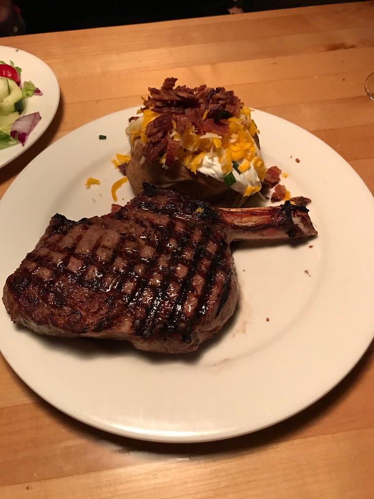
After a long 4 days of living out of a cooler and roadside food, we finally were able to grab a decent dinner....
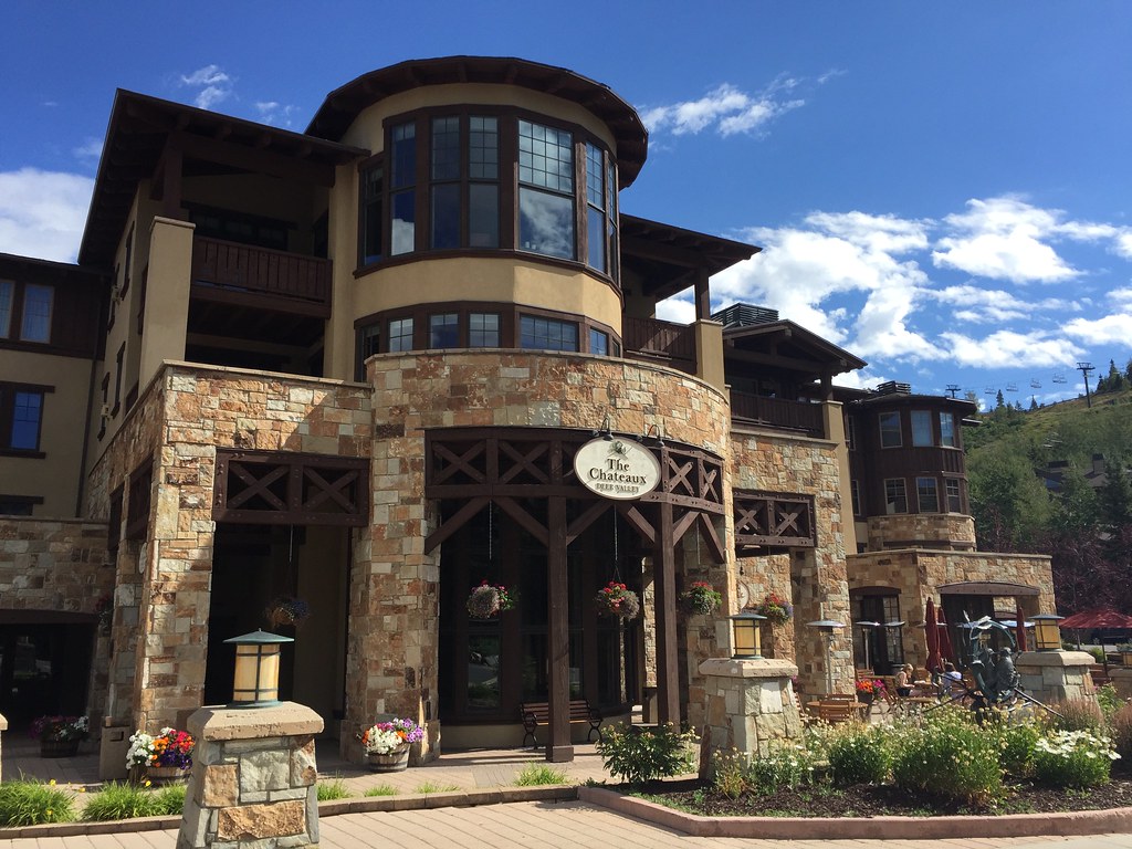
And take a day to rest up and recharge the ol' batteries in Park City UT, for tomorrow, I get to cross an item off my bucket list that I've been wanting to see with my own eyes for a LONG time.
We decided to pull over for a bite to eat, and have a little talk. We were approximately 590 miles away from Jackson at this point, and learning my lesson from our Hawaii trip (going to volcano national park during a time where the winds were blowing the wrong way and 95% of the park was closed) as well as my last trip where I was locked out of the shafer switchbacks, I decided to look up current conditions in the big parks. Now I should point out, a good number of locals advised me to stay away from these parks in August, as it is PACKED with tourists, on 1 lane roads, constant traffic jams (talking 2-3 hours+) and just generally a miserable time...so much so, that locals never go to these parks in the summer. I looked up the current conditions and Im reading there are fires throughout, and they are closing this entrance and that entrance, etc....learning my less from prior trips, we made the decision to scrap our northern route, save the Wyoming/Montana parks for another time (not peak season) and head south into Utah instead.
After a long 4 days of living out of a cooler and roadside food, we finally were able to grab a decent dinner....
And take a day to rest up and recharge the ol' batteries in Park City UT, for tomorrow, I get to cross an item off my bucket list that I've been wanting to see with my own eyes for a LONG time.
Labricon
Caught the Bug
Awesome so far. Look forward to more of your adventure!
Sent from my iPhone using WAYALIFE mobile app
Sent from my iPhone using WAYALIFE mobile app
Gadget
Caught the Bug
Great video, will there be a full length version and do we win shot glasses if we guess the length?
Sent from my iPad using WAYALIFE mobile app
Sent from my iPad using WAYALIFE mobile app
jeeeep
Hooked
our family used to go to that Little America for Sunday brunch once a month.
Good call on the detour, with all the fires in the area it would have been a miserable experience - and probably taken a few months to get the smoke smell out of everything.
I got caught having to cross through a fire when traveling through southern Utah a few years back, the fire smell permeates into everything!
Park City is a nice place to rest and recover.
Are you heading to Moab from there?
I feel for you on the photo mishaps. I used to take way too much photo equipment on trips, it would slow us all down and well...in my rush I'd forget to set something properly and end up with blur or just %^*%^% passengers :doh:
Hope you get rested up well and looking forward to the next leg of your trip :thumb:
TrailHunter
Hooked
This is AWESOME! My Dream to just Drive & Drive & Drive and see everything! Good for you!
TOPLESS
Active Member
For the past 3 days this is the thread I look for first to see the updates! Safe travels!
Sent from my iPad using WAYALIFE mobile app
Sent from my iPad using WAYALIFE mobile app
Zevulin
New member
sc_rhino
Member
Has this trip already happened or are you still traveling? I was at Glacier two weeks ago and made it before they shut down parts of it b/c of fire. Crowds weren’t too bad in Glacier or Yellowstone.
Sounds like you’re seeing a lot of Nat parks too. That’s my goal to see all of the parks in the next few years.
Was looking at pictures of Yellowstone and Glacier on Facebook and they are already getting snow so I guess Sept is hit or miss on weather to beat the crowds.
Sounds like you’re seeing a lot of Nat parks too. That’s my goal to see all of the parks in the next few years.
Was looking at pictures of Yellowstone and Glacier on Facebook and they are already getting snow so I guess Sept is hit or miss on weather to beat the crowds.
Last edited:
NFRs2000NYC
Caught the Bug
Thanks guys. The trip already happened, I am home now organizing my files and such, and posting as I process. ")
Linebacker
Caught the Bug
"And take a day to rest up and recharge the ol' batteries in Park City UT, for tomorrow, I get to cross an item off my bucket list that I've been wanting to see with my own eyes for a LONG time."
Really awesome trip, pics and video! And then a cliffhanger (love it). Gotta be the 70m ski jump hill from the '02 Olympics.
Really awesome trip, pics and video! And then a cliffhanger (love it). Gotta be the 70m ski jump hill from the '02 Olympics.
NFRs2000NYC
Caught the Bug
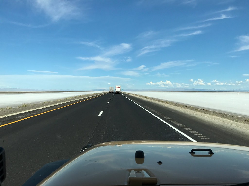
So we continued motoring down the interstate,
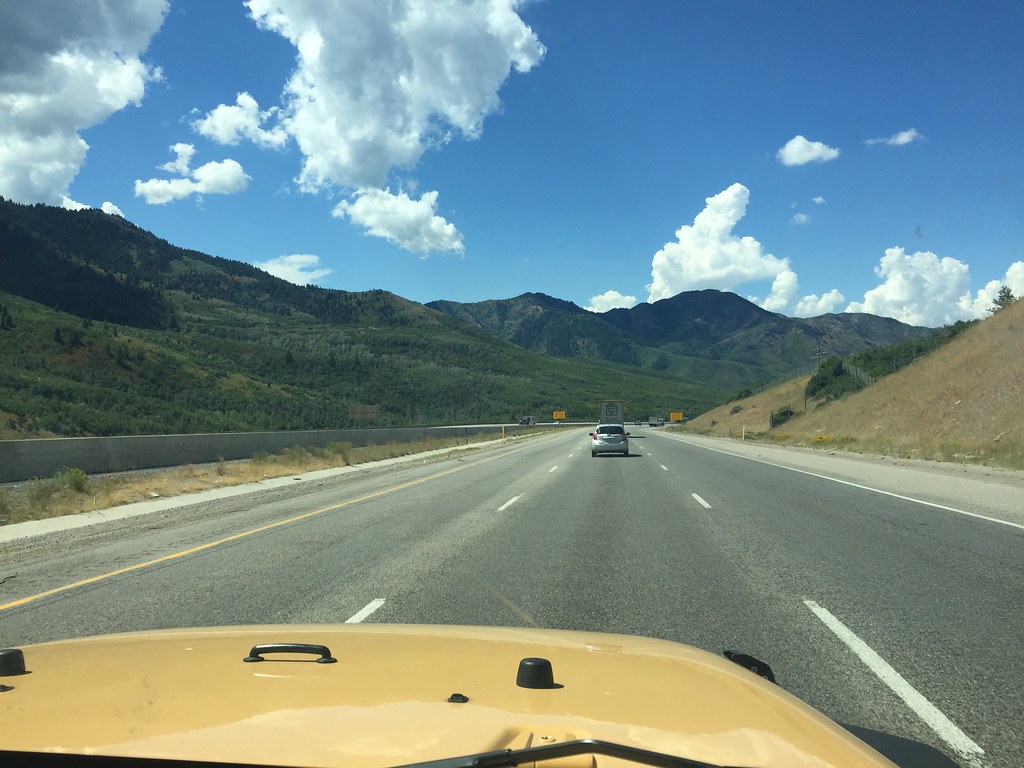
When I saw this in the distance...(note, this was not our destination)
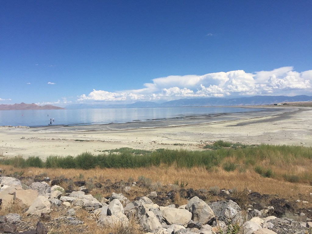
Then I saw a sign that said "Great Salt Lake State Park" and realized, hey, this is the actual salt lake, so lets pull over and take a look
The first thing you notice is the smell....the dead sea is 33% salt content, hence the name "dead"...nothing lives in it, not even bacteria. The Salt Lake is 5-27% salt, which isn't toxic enough, so there are living organisms in it, like brine shrimp, so the smell is quite potent. We also wanted to dip our feet in, you know, just to say we did it, but as we neared the shore, we noticed BILLIONS upon BILLIONS of tiny little flies, it was like walking through a walking cloud. The ranger at the visitor center said they are a few weeks away from dying off, but they were certainly in full force when we were there
So we dipped our feet, took a few pics, and were promptly on our way. I will say, that if you are passing by, it's worth a stop, but just like the 4 corners monument, it most definitely is NOT worth a detour.
So motoring down the interstate,
Much to the dismay of my wife, went off on another detour, again, into what looks like the back closet of Narnia...
and followed the track for a little while...
It was very loose and sandy, and was getting extremely steep, and even worse, it was steep AND off camber, something I wasn't super comfortable with being alone, but, I took is slow, and went up as high as I thought was safe....
At this point my wife is wondering where the hell I am going and where it's going to lead...she's also constantly comments on "oh my god, it's leaning over it's leaning over"....the off camber situation was getting pretty severe, to the point where I decided to make a safety call, and hike up to the top instead, so the last few hundred feet we walked.
Once again, this detour was for the little treasure hunt I've become addicted to, like Pokemon, trying to catch them all...
After this, we headed back to the interstate and continued to our destination....and came upon some weird things...
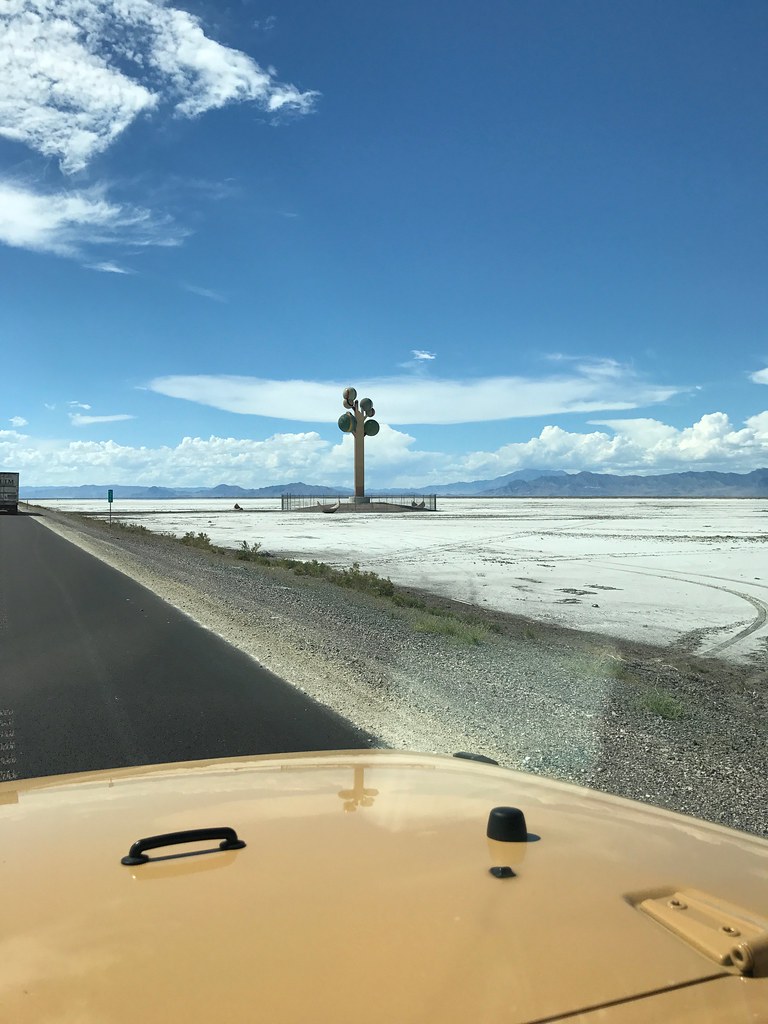
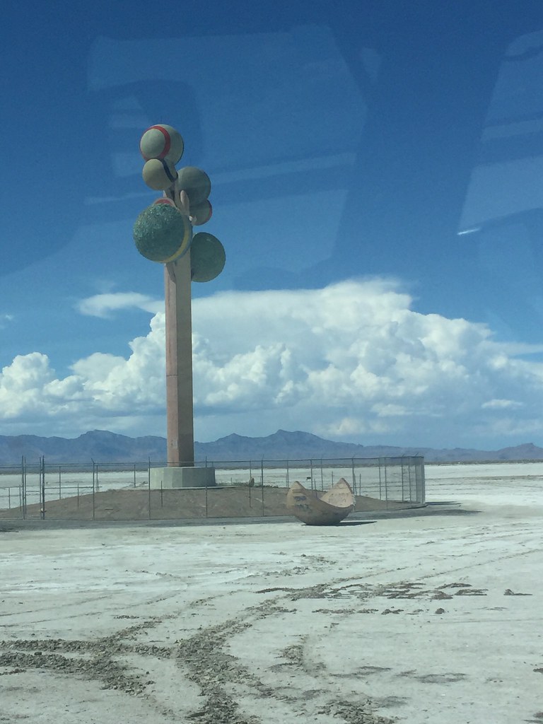
Anyone have any clue what the heck this thing is? I couldn't tell if it was art or some sort of a monitoring receiver, or a beacon for the clingons...
Down this road, you notice a TON of tire tracks going onto the surface, then immediately turning back. People try to save the 100 mile drive by trying to get on early, only to find out that it's just a massive layer of mud and if they are lucky, they can get out, but from what I hear, most of the time they need a tow truck and the bill is almost $2000.
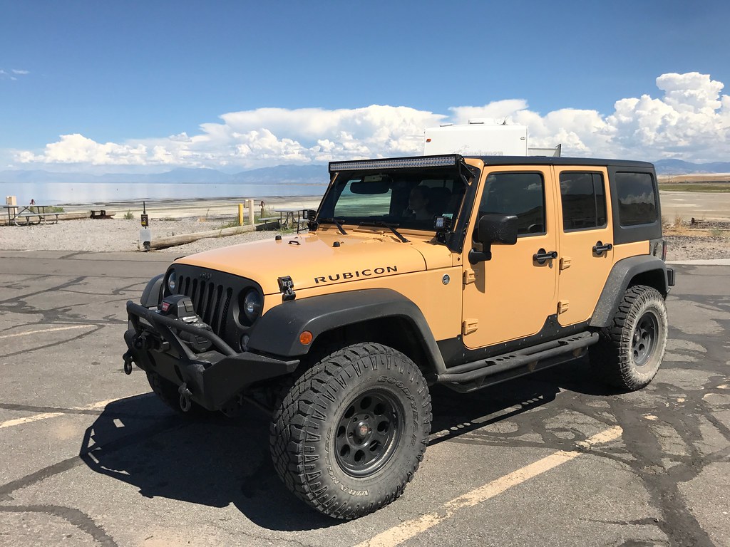
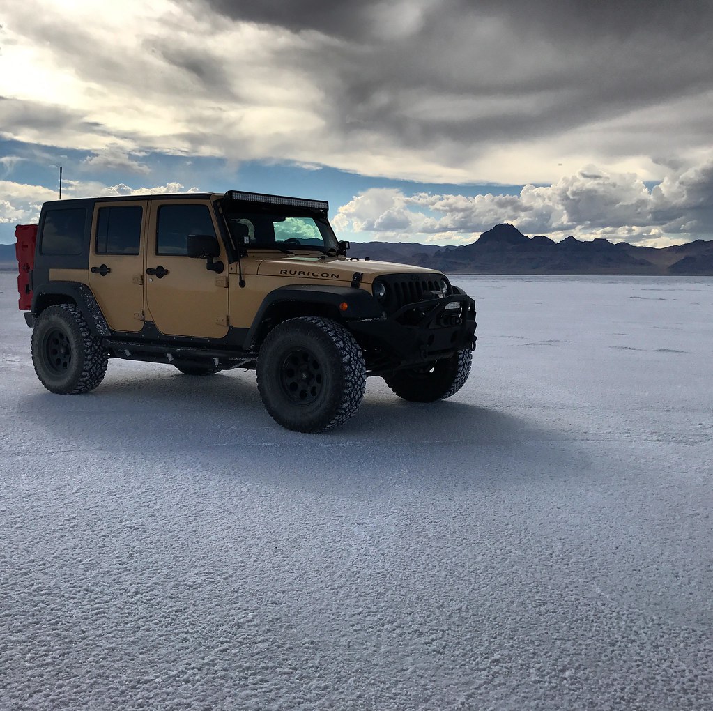
Finally, after a LONG drive, I arrived at a place I've wanted to visit since I was a kid...
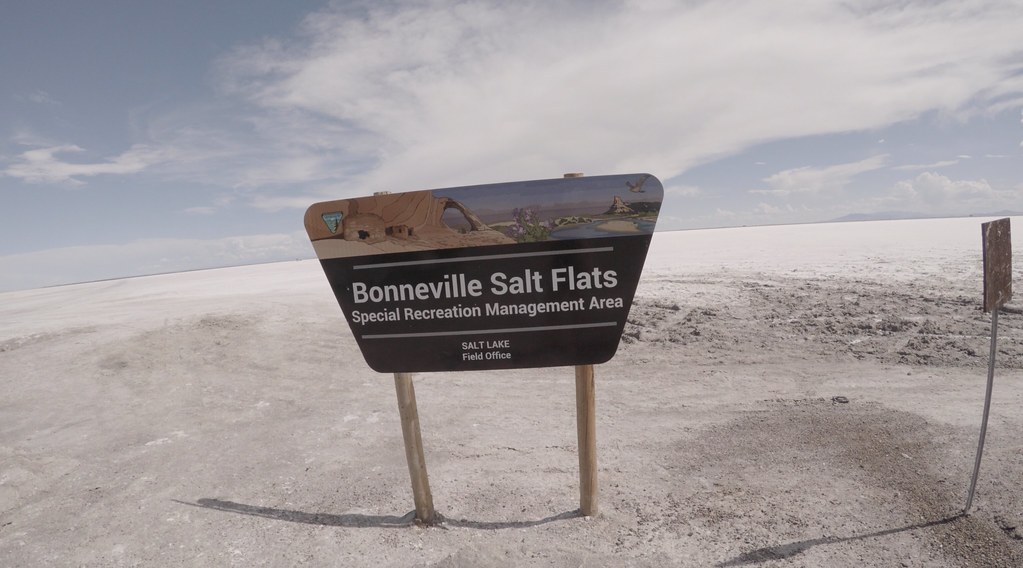
This place is like being on another planet, even my wife found it extremely cool and took more selfies than a teen night at a club. We also came to find out that the next day, there were races being held there, and the flats would be closed to the public....so you can imagine our relief that we were actually going to make it ONTO the salt!
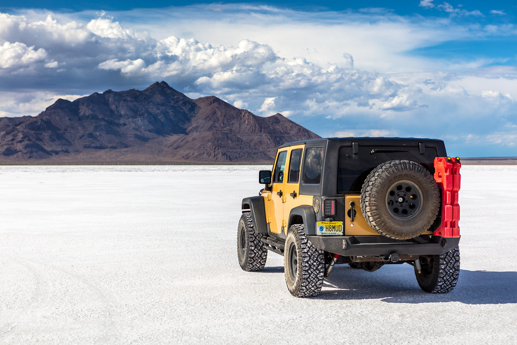
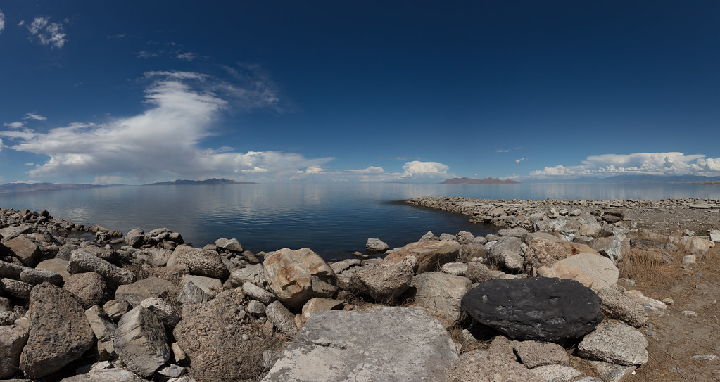
This place is absolutely stunning
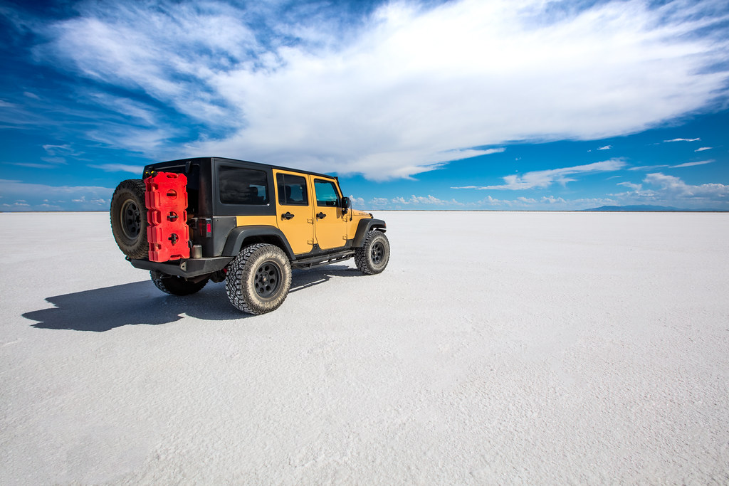
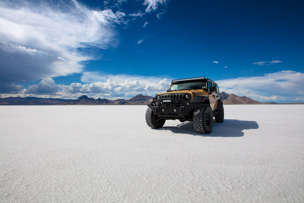
So after we took a lot of photos for my portfolio (I planned on doing it at glacier national park, so I had my wife pack a dress specifically for a shoot) as well as some personal ones, and enjoyed standing barefoot on the salt for a little while, we packed up, and started heading back towards the interstate....
When I saw this in the distance...(note, this was not our destination)
Then I saw a sign that said "Great Salt Lake State Park" and realized, hey, this is the actual salt lake, so lets pull over and take a look
The first thing you notice is the smell....the dead sea is 33% salt content, hence the name "dead"...nothing lives in it, not even bacteria. The Salt Lake is 5-27% salt, which isn't toxic enough, so there are living organisms in it, like brine shrimp, so the smell is quite potent. We also wanted to dip our feet in, you know, just to say we did it, but as we neared the shore, we noticed BILLIONS upon BILLIONS of tiny little flies, it was like walking through a walking cloud. The ranger at the visitor center said they are a few weeks away from dying off, but they were certainly in full force when we were there
So we dipped our feet, took a few pics, and were promptly on our way. I will say, that if you are passing by, it's worth a stop, but just like the 4 corners monument, it most definitely is NOT worth a detour.
So motoring down the interstate,
Much to the dismay of my wife, went off on another detour, again, into what looks like the back closet of Narnia...
and followed the track for a little while...
It was very loose and sandy, and was getting extremely steep, and even worse, it was steep AND off camber, something I wasn't super comfortable with being alone, but, I took is slow, and went up as high as I thought was safe....
At this point my wife is wondering where the hell I am going and where it's going to lead...she's also constantly comments on "oh my god, it's leaning over it's leaning over"....the off camber situation was getting pretty severe, to the point where I decided to make a safety call, and hike up to the top instead, so the last few hundred feet we walked.
Once again, this detour was for the little treasure hunt I've become addicted to, like Pokemon, trying to catch them all...
After this, we headed back to the interstate and continued to our destination....and came upon some weird things...
Anyone have any clue what the heck this thing is? I couldn't tell if it was art or some sort of a monitoring receiver, or a beacon for the clingons...
Down this road, you notice a TON of tire tracks going onto the surface, then immediately turning back. People try to save the 100 mile drive by trying to get on early, only to find out that it's just a massive layer of mud and if they are lucky, they can get out, but from what I hear, most of the time they need a tow truck and the bill is almost $2000.
Finally, after a LONG drive, I arrived at a place I've wanted to visit since I was a kid...
This place is like being on another planet, even my wife found it extremely cool and took more selfies than a teen night at a club. We also came to find out that the next day, there were races being held there, and the flats would be closed to the public....so you can imagine our relief that we were actually going to make it ONTO the salt!
This place is absolutely stunning
So after we took a lot of photos for my portfolio (I planned on doing it at glacier national park, so I had my wife pack a dress specifically for a shoot) as well as some personal ones, and enjoyed standing barefoot on the salt for a little while, we packed up, and started heading back towards the interstate....