Hey everyone, I just wanted to let you all know that Cindy and I will be heading up to Monache Meadows this coming weekend to celebrate the Summer Solstice! If you have the time and would like to come along, we'd love to have you join us.
For those of you who have never been up to Monache Meadows before, all I can say is that it is one of our favorite places to camp. The scenery is to die for, it's extremely remote, you get to camp right next to the South Fork Kern River and if you're into fishing, the waters are abundant with German Brown and Golden/Rainbow Trout. The trail up to Monache Meadows is super easy and you'll most likely never need to shift out of 2WD. Needless to say, if you are looking to do some rock crawling, this is NOT the trip for you. So that it's clear, this will just be a quick overnight R&R camping trip and if you'd like to come or have any questions, please let us know by posting on this thread.
THE PLAN:
We haven't decided yet but, there is a good chance that Cindy and I will head up on Friday to help ensure we get a good camp site. If we do this and you would like to join us, we will be meeting up with everyone at the Pearsonville Shell Gas Station at 10:00 AM. From there, we will be heading up to the Blackrock Ranger Station and plan to be there at about 11:30 AM. I will confirm all this as soon as I can. As for everyone else, you're free to meet up with us at camp and directions to it are posted below.
THINGS YOU NEED TO KNOW:
The last chance for you to get gas is at the Shell Station right off the 395 in the town of Pearsonville. Be sure to top off your gas tank here as Monache Meadows is a long way up and you'll want every last drop you can carry. You can also get a few last minute provisions here if needed. The closest real town beyond that is Ridgecrest if you need anything significant. Please be advised that this is all BACK COUNTRY DRY CAMPING. In other words, there are NO toilets and NO running water and everything you pack in MUST be packed out.
THINGS TO BRING:
According to NOAA which is normally very accurate, we should be looking at clear skies and temps in the mid 80's by day with lows in the low 40's by night. That's a pretty good swing in temps and of course, being that we'll be up in the Sierra's, there is always a chance of thunderstorms so please dress/pack accordingly. Regarding food & water, please pack your own and enough for you and your passengers for the duration of the trip.
SORRY - NO FIRES ARE ALLOWED AT THIS TIME
WHO'S GOING LIST:
1. Cindy & Eddie
2. Moochie
3. Trail Bud
4. DManuel (Dave & Laura)
5. JeepFan (Tony & Stephanie)
6.
HOW TO GET TO BLACKROCK RANGER STATION
From Pearsonville - Make sure to top off your tank here and then take 395 North for 2.4 and then turn LEFT onto Ninemile Canyon Rd.
• Ninemile Canyon Rd will become Kennedy Meadows Rd - Take this to Kennedy Meadows which is about 24 miles west
• Make a LEFT turn onto 22S05/Sherman Pass Rd and Drive 12.7 miles to Fish Creek Rd.
• Just after making your LEFT turn, you should see the Blackrock Ranger Station on the right.
From Lake Isabella - From the 178, take the 155 North to Kernville which is about 11.7 miles away.
• Top off your tank at Kernville and then continue to 22S05/Sherman Pass Rd. which is 19.2 miles to the north.
• Turn RIGHT onto 22S05/Sherman Pass Rd. and head East 28.5 miles until you reach a T in the road.
• Turn LEFT and head North 2.5 miles to Fish Creek Rd.
• Just after making your LEFT turn, you should see the Blackrock Ranger Station on the right.
MONACHE MEADOWS CAMP
• From Blackrock Ranger Station (N36 05 40.7 W118 15 52.4) - drive 2.1 miles north and then make a RIGHT turn onto 21S03 (N36 07 20.5 W118 15 46.7)
• Drive 6 miles north and you should arrive at a staging area and campground (N36 09 44.4 W118 13 54.3). There is a sign here that indicates the Monache Trail.
• Follow the main trail as it meanders through the forest and when you get to the access gate, open it, drive through it and then be sure to close it behind you.
• Keep following this long trail until you reach the South Fork Kern River (N36 12 27.8 W118 10 32.1)
• At the river, make a LEFT (DO NOT cross the river) and follow along side it for about 1 mile.
• At the intersection (N36 13 16.5 W118 10 38.1), stay to the LEFT and drive about .75 miles
• At the intersection (N36 13 22.3 W118 11 19.0), make a RIGHT and follow the signs indicating campgrounds ahead. If you find yourself on top of the Bake Oven dune, you've gone the wrong way.
• Drive about 2 miles into the forest and you will end up at camp (N36 14 18.8 W118 11 09.6)
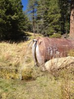
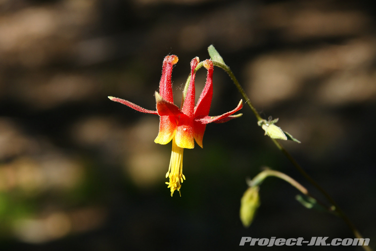
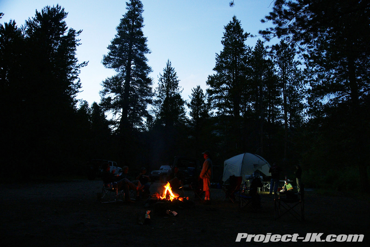
WHAT YOU CAN EXPECT TO SEE
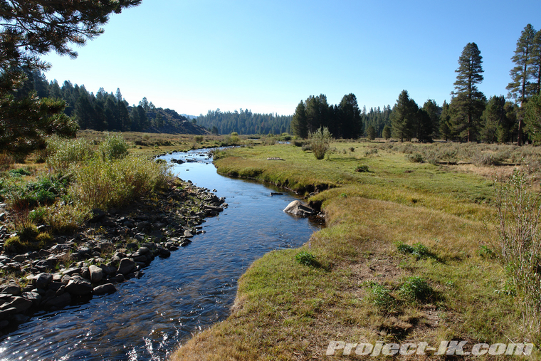
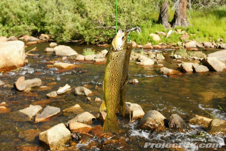
For those of you who have never been up to Monache Meadows before, all I can say is that it is one of our favorite places to camp. The scenery is to die for, it's extremely remote, you get to camp right next to the South Fork Kern River and if you're into fishing, the waters are abundant with German Brown and Golden/Rainbow Trout. The trail up to Monache Meadows is super easy and you'll most likely never need to shift out of 2WD. Needless to say, if you are looking to do some rock crawling, this is NOT the trip for you. So that it's clear, this will just be a quick overnight R&R camping trip and if you'd like to come or have any questions, please let us know by posting on this thread.
THE PLAN:
We haven't decided yet but, there is a good chance that Cindy and I will head up on Friday to help ensure we get a good camp site. If we do this and you would like to join us, we will be meeting up with everyone at the Pearsonville Shell Gas Station at 10:00 AM. From there, we will be heading up to the Blackrock Ranger Station and plan to be there at about 11:30 AM. I will confirm all this as soon as I can. As for everyone else, you're free to meet up with us at camp and directions to it are posted below.
THINGS YOU NEED TO KNOW:
The last chance for you to get gas is at the Shell Station right off the 395 in the town of Pearsonville. Be sure to top off your gas tank here as Monache Meadows is a long way up and you'll want every last drop you can carry. You can also get a few last minute provisions here if needed. The closest real town beyond that is Ridgecrest if you need anything significant. Please be advised that this is all BACK COUNTRY DRY CAMPING. In other words, there are NO toilets and NO running water and everything you pack in MUST be packed out.
THINGS TO BRING:
According to NOAA which is normally very accurate, we should be looking at clear skies and temps in the mid 80's by day with lows in the low 40's by night. That's a pretty good swing in temps and of course, being that we'll be up in the Sierra's, there is always a chance of thunderstorms so please dress/pack accordingly. Regarding food & water, please pack your own and enough for you and your passengers for the duration of the trip.
SORRY - NO FIRES ARE ALLOWED AT THIS TIME
WHO'S GOING LIST:
1. Cindy & Eddie
2. Moochie
3. Trail Bud
4. DManuel (Dave & Laura)
5. JeepFan (Tony & Stephanie)
6.
HOW TO GET TO BLACKROCK RANGER STATION
From Pearsonville - Make sure to top off your tank here and then take 395 North for 2.4 and then turn LEFT onto Ninemile Canyon Rd.
• Ninemile Canyon Rd will become Kennedy Meadows Rd - Take this to Kennedy Meadows which is about 24 miles west
• Make a LEFT turn onto 22S05/Sherman Pass Rd and Drive 12.7 miles to Fish Creek Rd.
• Just after making your LEFT turn, you should see the Blackrock Ranger Station on the right.
From Lake Isabella - From the 178, take the 155 North to Kernville which is about 11.7 miles away.
• Top off your tank at Kernville and then continue to 22S05/Sherman Pass Rd. which is 19.2 miles to the north.
• Turn RIGHT onto 22S05/Sherman Pass Rd. and head East 28.5 miles until you reach a T in the road.
• Turn LEFT and head North 2.5 miles to Fish Creek Rd.
• Just after making your LEFT turn, you should see the Blackrock Ranger Station on the right.
MONACHE MEADOWS CAMP
• From Blackrock Ranger Station (N36 05 40.7 W118 15 52.4) - drive 2.1 miles north and then make a RIGHT turn onto 21S03 (N36 07 20.5 W118 15 46.7)
• Drive 6 miles north and you should arrive at a staging area and campground (N36 09 44.4 W118 13 54.3). There is a sign here that indicates the Monache Trail.
• Follow the main trail as it meanders through the forest and when you get to the access gate, open it, drive through it and then be sure to close it behind you.
• Keep following this long trail until you reach the South Fork Kern River (N36 12 27.8 W118 10 32.1)
• At the river, make a LEFT (DO NOT cross the river) and follow along side it for about 1 mile.
• At the intersection (N36 13 16.5 W118 10 38.1), stay to the LEFT and drive about .75 miles
• At the intersection (N36 13 22.3 W118 11 19.0), make a RIGHT and follow the signs indicating campgrounds ahead. If you find yourself on top of the Bake Oven dune, you've gone the wrong way.
• Drive about 2 miles into the forest and you will end up at camp (N36 14 18.8 W118 11 09.6)
WHAT YOU CAN EXPECT TO SEE