JEEP TRAIL OFFROAD GPS: What GPS is everyone running?

rdreng

New member
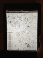
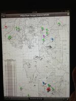
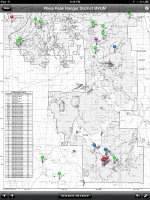
I found this app last night called PDF Maps. It has all of the Colorado MVUM maps for free and the app is free. I have not had a chance to mess with it to much other then download the maps and view them cut appears it can overlay your gps location so it's like carrying the actual MVUM but with GPS points. Kinda cool. I looked at the Gaia app last night to, but wasn't sure if I could get those forest service maps uploaded.

Ldogg -

Thank you for posting this on PDF Maps. I downloaded the App to my phone tonight and am in the process of downloading the Ranger District maps for the San Juan Forest in Colorado. This looks like it will be a handy mapping tool for my upcoming trip to Durango, CO.

Its appreciated,
Alan
 

Ldogg

New member
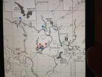
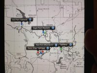
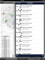
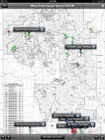
No problem! It's a sweet app. I have been playing around with it more and found that you can input GPS coordinates to find waypoints and you can import and export the waypoints you create. So I have started mapping a bunch for the pikes peak ranger district on my iPad mini and then export/import onto my iPhone. I have color coded them to make it easy to find what i want to run on a certain day. Purple is paved road. Red, blue, green is standard color designations. I have not had a chance to use its built in GPS feature to show you where you are on the map but it looks promising and hey it's free!

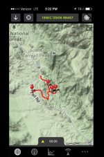
ImageUploadedByWAYALIFE1375239998.829195.jpg ImageUploadedByWAYALIFE1375240009.585134.jpg ImageUploadedByWAYALIFE1375240018.985267.jpg ImageUploadedByWAYALIFE1375240047.702285.jpg
 

Ldogg

New member
I have been using the funtreks book and traildamage to get my gps points for the trail heads.
 

rdreng

New member
I have been using the funtreks book and traildamage to get my gps points for the trail heads.

I have used the Funtreks "Guide to Colorado Backroads and 4WD Trails" the last couple of years. We do a lot of "exploring" with our Jeep (not rock crawling).

The built-in Nav system in the Jeep is not very useful when exploring trails. It is difficult get a big picture with it. When I zoom out, most of the trails disappear from the screen. Zoom-in to see the trail your on and you loose the big picture.

So I needed something different and it looks as if the PDF_Maps app you have posted might just do the trick (for Colorado Forests at least). I have downloaded all the MVUM district maps for the San Juan National Forest, the Grand Mesa, Uncompahgre, and Gunnison National Forests, and the Rio Grande National Forest.

I'll load the coodinates provided by the Funtrek book into each of the maps as you have shown above. The iPhone 5 screen is a little small. Looks like I may need to buy an iPad as you have shown in your pictures above.

Is Trail Damage a website or book?
 

Ldogg

New member
Traildamage is a website that has tons of Colorado trails listed, and has pictures and sometimes videos of trails. It's a great resource. I will post some screen caps from my iPad mini tonight so you can get a good idea of the size of what you see. It is by far alot easier to use vs my iPhone, and you can export and import between them which is handy for sure.
 

Fragsrus

New member
GPS App for the trails

Can anyone suggest a good Android GPS app for while out on the trails? Something that can read the .TPO files from sites such as nwjeepn.com. Right now I am using a free app called GPS Essentials, but it is fairly limited on options.
 

Heholua

Member
Can anyone suggest a good Android GPS app for while out on the trails? Something that can read the .TPO files from sites such as nwjeepn.com. Right now I am using a free app called GPS Essentials, but it is fairly limited on options.

From the research I've been doing, the apps that are recommended are Backcountry Pro and CoPilot. I purchased a Nexus 7 today for this purpose.
 

WhiteDynamite

New member
I use Gaia on my iPad. I believe they have an Andriod version as well. It's great. They have a cloud service that syncs your routes and waypoints to all your devices and online. If your anal like me, you can go online and access your stuff and edit names, locations and whatever else you want.
 

Heholua

Member
I use Gaia on my iPad. I believe they have an Andriod version as well. It's great. They have a cloud service that syncs your routes and waypoints to all your devices and online. If your anal like me, you can go online and access your stuff and edit names, locations and whatever else you want.

Thanks!! I will check it out.
 

Fragsrus

New member
I just checked out CoPilot, the free version, and I cannot see where it will allow me to use the .tpo files from nwjeepn.com. I do like the idea that it pre-downloads the maps for offline use though. From what I read the only thing you get with the paid version is turn-by-turn voice nav and some other frivolous nav features. I may try out Backcountry Pro closer to the summer when we go out again since it has a 21 day trial period. Gaia also seems like a good contender, but without any kind of trial I am hesitant to make a purchase just yet.
 

ziggy

New member
Great Trail Mapping APP

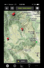
I have an app for my iphone (not sure if they have it for Android) called GPS KIT. I have attached a few screen shots of it. To date this is the best APP I have found for when you go out backcountry wheeling or just out for a little drive. It lets you download the GPS waypoint and GPX files from traildamage and import them right into the app.

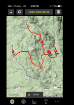
This is a shot of what the trail track would look like once you import it. The pins are waypoints that you can download also for challenges on the trail.

GPS Kit1.png

This is a zoomed out shot showing multiple trail tracks that I have imported and shows you the green triangle (you) in reference to your location using the gps function of your phone. It will track in real time once you start moving.

GPS Kit2.png

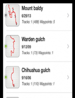
This is a photo of how the tracks are stored on the app.

GPS Kit3.png

A move zoomed in shot of a trail track. Once you are at the trailhead the green triangle will trace the track. All you have to do is follow the track. I have not gotten turned around once using this app.

GPS Kit4.png

I have changed mine from using the regular GPS coordinates to using the MGRS system that I am more familiar with. It will also display your elevation, speed, distance, etc.

Great app, very detailed and you can download the maps for offline viewing when you will be out of cell tower range. Your GPS will still track if you go out of coverage. Hope this helps you guys.
 
I use Gaia on my iPad. I believe they have an Andriod version as well. It's great. They have a cloud service that syncs your routes and waypoints to all your devices and online. If your anal like me, you can go online and access your stuff and edit names, locations and whatever else you want.

X2! :thumb:
 

Armydog

New member
I use the GridNav2 app on my iPad. But use it to reference back to a MGRS map. Old school I guess but I'm an old dog....
 

NFRs2000NYC

Caught the Bug
I use Gaia on my iPad. I believe they have an Andriod version as well. It's great. They have a cloud service that syncs your routes and waypoints to all your devices and online. If your anal like me, you can go online and access your stuff and edit names, locations and whatever else you want.

This. From what I gather, Gaia is the benchmark. I use it on my iphone and it has been great.
 

Turbostevey

New member
I have Gaia as well, and it worked wonderfully until the lasted update. Since then has not even started. Continues to crash.

Sent from my HTCONE using WAYALIFE mobile app
 

chaseit1

New member
Android Tablet GPS programs

Well after going to King of the Hammers this last week as a volunteer and not being extremely familiar with trail locations,I was wondering if there are any GPS programs or apps that would yield the ability to navigate in open offroad terrain. If anyone has input I would greatly appreciate the feedback.
 
Top Bottom