You are using an out of date browser. It may not display this or other websites correctly.
You should upgrade or use an alternative browser.
You should upgrade or use an alternative browser.
JEEP TRAIL OFFROAD GPS: What GPS is everyone running?
- Thread starter JandSJK
- Start date
Eddie,
So on the Gaia app I can down load topo maps from the app before I leave on a trip and then track myself even after I loose service? Or do I have to upload the topo maps from somewhere else to the app?
Thx
You can download a designated area on the app while you still have wifi or reception. When you no longer have service, you can still see where you're at in that area. Does that make sense?
JeepinLife
Caught the Bug
If you can find apps or software thats stand-alone and uses full maps you dont need service. Your can shut off data and still have map layover.
Last edited:
Gps Devices. Jeep Trails Hiking
What type of GPS equipment is best suited, most used when running areas such as Moab. I own a 2010 Rubicon Unlimited which has the factory touch screen Nav system. Considering a hand held. Any thoughts, suggestions will be appreciated! Eddie your thoughts?
What type of GPS equipment is best suited, most used when running areas such as Moab. I own a 2010 Rubicon Unlimited which has the factory touch screen Nav system. Considering a hand held. Any thoughts, suggestions will be appreciated! Eddie your thoughts?
jhires
Member
My wife and I take both her iphone and ipad with the ap Tremble Outdoors. It does require a bit of planning in advance though. You need to download the maps for the area you are going to be at in advance of losing cell service. The phone can record the gps track to share. She thinks the ipad ap can too, but not sure. Being able to track and plan on a topographic map is incredibly handy.
I haven't tried the previous ap mentioned, but will look into it.
I haven't tried the previous ap mentioned, but will look into it.
Gps
I use a GPS receiver called "DUAL" it interfaces via Bluetooth with virtually any display that accepts the Bluetooth signal. The 7" Nexus tablet is what I use but that's where preference of I've and mounting enter. The 7" tablet fits quite nice in my 2012 dash tray. A dedicated GPS receiver is much better (accurate/ faster)IMHO. I'd attend a couple of runs and look firsthand at what others are running, usually everyone is happy to discuss there choices. The mapping platform and it's ease of use is the real challenge. Thank goodness they're reasonable so you can change if you need different results.
I use a GPS receiver called "DUAL" it interfaces via Bluetooth with virtually any display that accepts the Bluetooth signal. The 7" Nexus tablet is what I use but that's where preference of I've and mounting enter. The 7" tablet fits quite nice in my 2012 dash tray. A dedicated GPS receiver is much better (accurate/ faster)IMHO. I'd attend a couple of runs and look firsthand at what others are running, usually everyone is happy to discuss there choices. The mapping platform and it's ease of use is the real challenge. Thank goodness they're reasonable so you can change if you need different results.
BlackDiamondBound
New member
smart phone apps. I create off line maps of where im going and then use the gps on the phone.
OverlanderJK
Resident Smartass
Gps
Does it work without wifi or 3G or are they needed?
If you're using an IPad try Scenic Maps Western. It downloads and you have it all no need to download every time you change locations and it costs the exorbitant sum of $10
Does it work without wifi or 3G or are they needed?
Ldogg
New member
Gps
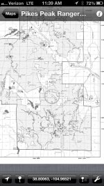
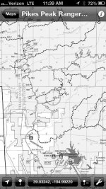
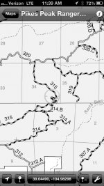
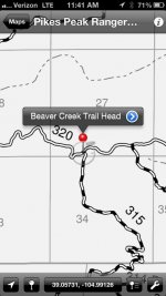
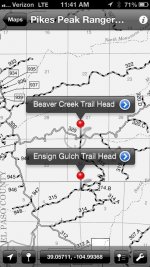
I found this app last night called PDF Maps. It has all of the Colorado MVUM maps for free and the app is free. I have not had a chance to mess with it to much other then download the maps and view them cut appears it can overlay your gps location so it's like carrying the actual MVUM but with GPS points. Kinda cool. I looked at the Gaia app last night to, but wasn't sure if I could get those forest service maps uploaded.
I found this app last night called PDF Maps. It has all of the Colorado MVUM maps for free and the app is free. I have not had a chance to mess with it to much other then download the maps and view them cut appears it can overlay your gps location so it's like carrying the actual MVUM but with GPS points. Kinda cool. I looked at the Gaia app last night to, but wasn't sure if I could get those forest service maps uploaded.
OverlanderJK
Resident Smartass
Gps
I want it for my ipad anyway. :thumb:
To answer your question after initial download its all on your machine , no further wi-fi or 3G needed which makes it stand alone and "trail rated" in my book. Check out the demo, only drawback is it's only for IPad
I want it for my ipad anyway. :thumb:

