Jeepin' Across America, The Adventure Continues!

NFRs2000NYC

Caught the Bug
Day 2

We woke up to the stunning beauty of Telluride...really a beautiful town. Well rested and eating a nice breakfast, it was time to head out for today's adventure. Today's fun was something I have been looking forward to all year. Those of you that remember my Moab thread will remember that I only did Moab because all the trails I wanted to run in Colorado were still closed in May. Granted, I'm glad I went to Moab, but I have been wanting to run Imogene pass since I learned about it. So, off we went.

Telluride mornings are beautiful. Clear skies, crisp air, amazing.


The beginning on the trail (it can be run both ways, but it's usually better to start in Telluride...the other end is Ouray, another amazing town) starts out in a communal driveway.


After the driveway, you are deep inside the forest, inside the tree line, and the bugs are biblical. Flies everwhere!!! After about a mile, you begin to gradually climb.


Imogene pass is the second highest drivable trail in Colorado. Monsquito pass is the first. Imogene tops out at 13,114 feet!

As you continue the climb, the shelf roads begin. There are parts of it where the tires will literally be inches from the edge (depending on your vehicle and axle stance)...for me it wasn't an issue, as I don't mind shelf roads, by the wife started to get nervous. If you are trying to ease someone into the Jeeping lifestyle, this is NOT the way to do it.


You can see how much room to have for error...and this is an "easy" section.


We arrived at a little pull off (passing is dangerous and often impossible on Imogene, so you must look and think ahead, otherwise backing up would really pucker up your butthole) which had the remains of an old small mine.


9372462575_683ee0f4ff_c.jpg


9372464011_333627219b_c.jpg


The climb continued, and we are now starting to get above the treeline.


There is no reset button...one wrong move, and it's game over.


As we got near the summit (11,500 feet or so) it became really rocky, steep, and narrow. At one point, I had to stop and help a guy on a BMW bike to turn around. I met him at the base, and he didn't realize how steep it was, and ended up smoking his clutch. He had a long way to go (he was doing a roadtrip to Oregon) and didn't want to kill it completely. He was unable to turn it around alone because everytime he tried, the bike kept tipping over. After helping him (man was he happy to see me) I finally made it up to the summit.

9372466635_d048050bff_c.jpg


9372467433_995f1d7226_c.jpg


Coming from sea level, and since this was only our second day here, being at 13000+ft gave breathtaking a new meaning. Breathing was not an issue until I tried doing something. Lifting the camera bag made me breathe harder. Luckily I didn't have any other symptoms, like headaches, but we didn't linger here for too long. We had a rocky descent into Ouray ahead of us.
 

NFRs2000NYC

Caught the Bug
The climb to the top of imogene is rather mild. A good 4x4 with low range and a decent set of tires will get up there. There are some crazy tippy spots, and some very rocky spots, but a 4Runner that was trailing me had no real problems making it UP....down is another story...more on that later.

The route from Telluride to Ouray means that you climb up the easier side (the Telluride side) and descend down the Ouray side (more difficult and rocky)...doing the trip in reverse is of course possible, but ill advised. One of the major rules of these trails is (some exceptions apply, depending on circumstances) uphill traffic has the right of way.

The ascent starts with a rocky road, but nothing of note. Pictures unfortunately don't do the surface justice...it looks like a parking lot on the photos and videos, but I assure you, it isn't. I saw two other SUVs (a Tiguan and a Rav4) turn around after they popped their tires. The rocks are sharp!

So the start is fairly mild...


The shelf road begins at about 1.5 miles into the trail.


Passing is now much more difficult, especially if the other vehicle is less rugged and can't climb up on the bank.


Close to the edge...


After another mile or so, you come to a "tunnel"....obviously there is no room to pass, so someone needs to get out and check if any traffic is coming.


Whenever you are on a trail (or a road) with blind curves, it is always good practice to give an audible signal that "someone is coming" by beeping your horn twice.

Looking across the valley you can see the switchbacks of the infamous black bear pass.


More on blackbear pass later.

After a minor climb, the trail levels out for a bit, so you can catch a breather.


Once you get to the disused mine, it starts to get rocky and steeper again.


Coming up to the mine...


A few creeks flowing nearby, in case you want to wash up.


At some points, the trail gets rockier and tippy in spots. This is a mindscrew. Trust your vehicle and don't panic.


After another mile or so, you are above the treeline, and things start to get much more rocky.


Another 4000 feet left to go!


There are many instances where you can't see the ground. If you don't have a spotter, sometimes hanging out the window to make sure your tires stay on the ground is a necessity.


Another mindscrew...


At a certain point, you will be completely above the vegetation line. I suspect this has something to do with the temps and the lack of oxygen, but Im not botanist.


Some more shelf road fun


The views are getting better and better....


Now completely above vegetation


Peeking over to the summit!
 

tugoo

New member
Man, I am glued to this post like a fly stuck in honey...biblical that is!


Sent from my iPhone using WAYALIFE mobile app
 

NY1982JK

New member
Man this is amazing. I have dreams of doing a trip pretty much exactly like this. So jealous. And so subscribed!

Sent from my SPH-D710 using WAYALIFE mobile app
 

NFRs2000NYC

Caught the Bug
Now it was time to descend. The descent is mentally easier because you can see where you are going...climbing always puckers the cheeks because you often are looking at nothing but sky. There were a few oh sh!t spots where the wife grabbed the Jeep's "oh sh!t" bar and was REALLY nervous...so, down we go!


At first things weren't too bad. I have read that the Ouray side is worse than the Telluride side, but things "seemed" ok...at first....


Thankfully the Jeep has hill descent, which makes your life a LOT easier, letting you concentrate on other things. Things started to get tippy and off-camber.


After the first few switchbacks, I realized why they said the Ouray side was more difficult...it was a lot rockier, and the rocks are all loose...not something you want to feel/see on a shelf road!


Although the pics don't show it, this slope is about 35-40 degrees. The wife ran down to take this pic, but was unable to stop and literally slid on her a$$. I saw a few rigs (mostly rental Jeeps) riding their brakes for this descent. At the next pulloff, i had to tell them that if they want to live to see another day, to stop using their brakes and start using the low gear crawling and hill descent control.


Here is a short vid of me creeping down this slope.

http://www.youtube.com/watch?v=koDpcAP3lyg

This is where the length of the unlimited becomes detrimental...backing up isn't fun on these roads.

http://www.youtube.com/watch?v=fka20LwvIXQ

This is what you see when driving on a steep shelf road...

http://www.youtube.com/watch?v=qDRhhIfFDbQ

At this point, there was a ledge that required "plopping" down slowly. Remember the 4Runner I was talking about earlier? Well, I lingered up at the summit for a bit to snap a few shots, and he went down first. I finally caught up to him and saw his rear end dangling in the air. Looking at the situation closely, I realized he had gone down at an angle and his front bumper was buried in the dirt (similar to how clarkson bottomed out the range rover in the Bolivia challenge going down the gulley.) I hooked my winch up to his rear end and yanked him up. He was really glad to see me too. Unfortunately, I was so busy helping the guy that I forgot to take a video of it.

So, still descending the mountain, I saw that it was still a LONG way down. 13 miles never felt so long.


As you descend the mountain back into the vegetation, the wildflower bloom was incredible. All different colors, as far as the eye can see.


Pulled over for a few more snaps

9372468303_34256bc5a9_c.jpg


9372468973_d594e183a8_c.jpg


Finally, after making it down to the treeline, we were almost home free, just a few minor water crossings to go through...

 
Last edited:

NFRs2000NYC

Caught the Bug
As we got closer to the bottom, we see some commotion up ahead...somehow, the driver of this buggy managed to slip one wheel off and was dangling over the drink...


After offering my help, but seeing that he was in good hands, we stood clear and let the recovery commence. They were really appreciative of the help. A very nice old couple that has just out having a good time.

http://www.youtube.com/watch?v=Nd0WLa_y_vs

We arrived in Ouray, and what a beautiful town it is. It is known as the Switzerland of America.


After grabbing some late lunch, we decided to head back to Telluride (Imogene took nearly 7 hours with all the stops) for dinner and an early bedtime because tomorrow would be even more action packed than today. Off we went, on tarmac roads to save some time. The distance from Ouray to Telluride is about 50 miles or so. The first 25 of them are tarmac. You then have a choice. You can finish the other 25 on tarmac as well, or make a left into the Last Dollar Road. This isn't a difficult trail or anything, more of a dirt road, but it's supremely pretty, passing by lots of ranches, mountains, etc. I quickly chose to hit the dirt.

The road is suitable for any vehicle, but I can't imagine it would be too comfortable.


It was just nice and peaceful to take this route rather than a highway route. Being alone, no traffic, no care, quite relaxing.


We finally arrived back in Telluride, where I once again used hotwire to extend our stay at the hotel Telluride (we loved it), grabbed a quick dinner, and went to bed. Tomorrow would be another day...a day that almost turned very sour.
 

NFRs2000NYC

Caught the Bug
DAY 3

Today is an action packed day, and one I will remember for a LONG time.

We woke up in Telluride, and the first trail of the day would be Ophir pass. Ophir pass is a convenient way to get from Telluride to Silverton, another old mining town. The trail is 13 miles long, as opposed to nearly 70 miles of road driving. So, once again, away we go.

The trail starts off as a mildly rocky road, but nothing of note. Most of the trails start out like this.


Shortly after, you begin to climb


My wife saw a grader at the bottom, and was excited that this would be a walk in the park, little did she know the grader only does the bottom mile because there are houses scattered around the tiny town of Ophir.


Here you can see the tiny town of Ophir. It is most houses, with a few businesses scattered about, but I would say it is 95% residential.


After you pass the town, the trail really begins...through the trees and through the flies!


These rocks are sharper than they look on photos.


Once you get above the tree line, the road once again, gets rocky, tippy, and narrow. Passing becomes an issue, but we encountered very little traffic on this one.


The views were getting even more screensaver-ey.
 

NFRs2000NYC

Caught the Bug
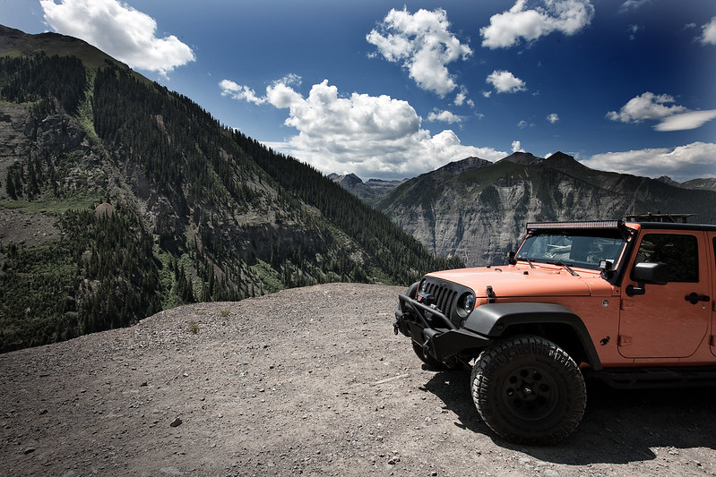
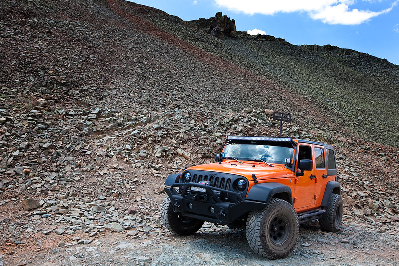
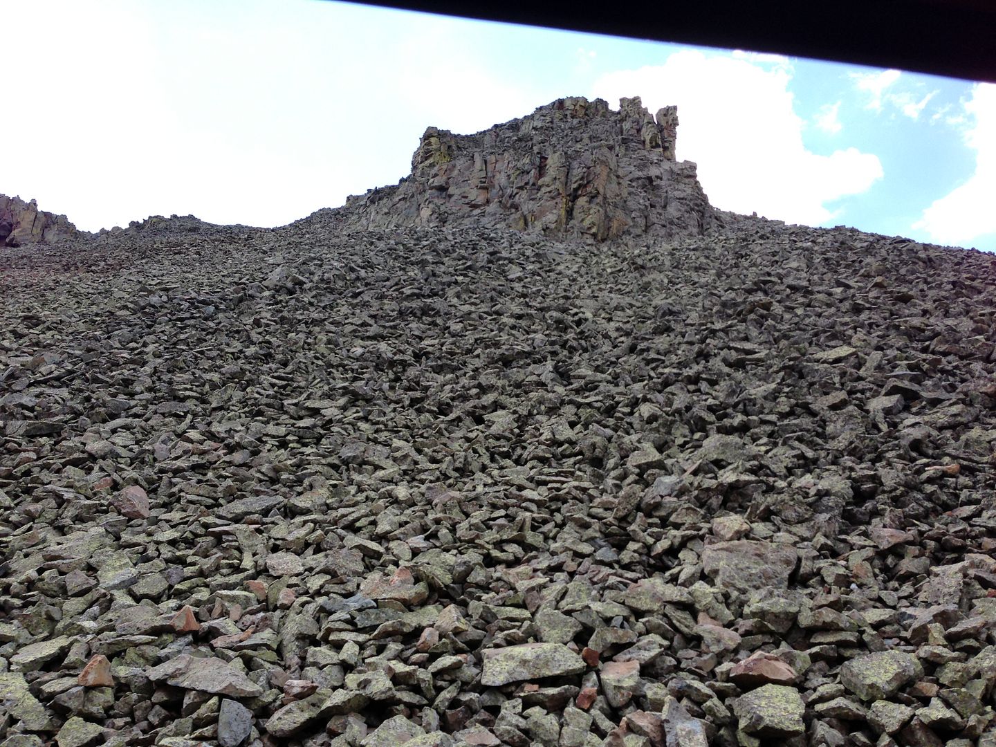
Once you get above the vegetation line, the surface becomes very rocky and nothing but loose rock like this.


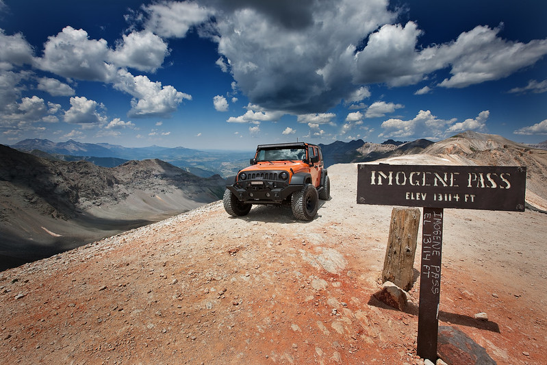
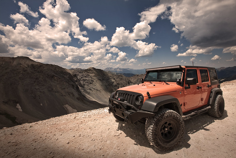
After a final push of 1100 feet, we reached the summit.
9372474017_6b75787fb8_c.jpg


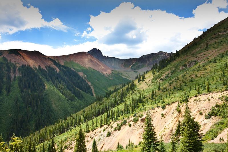
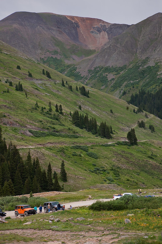
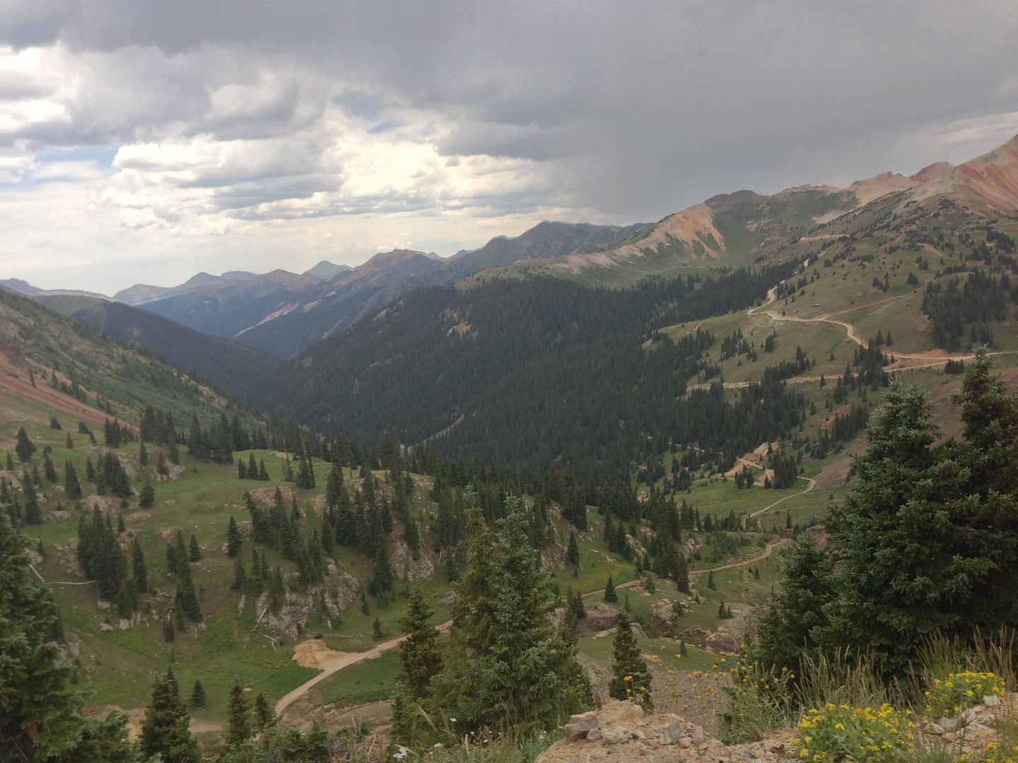
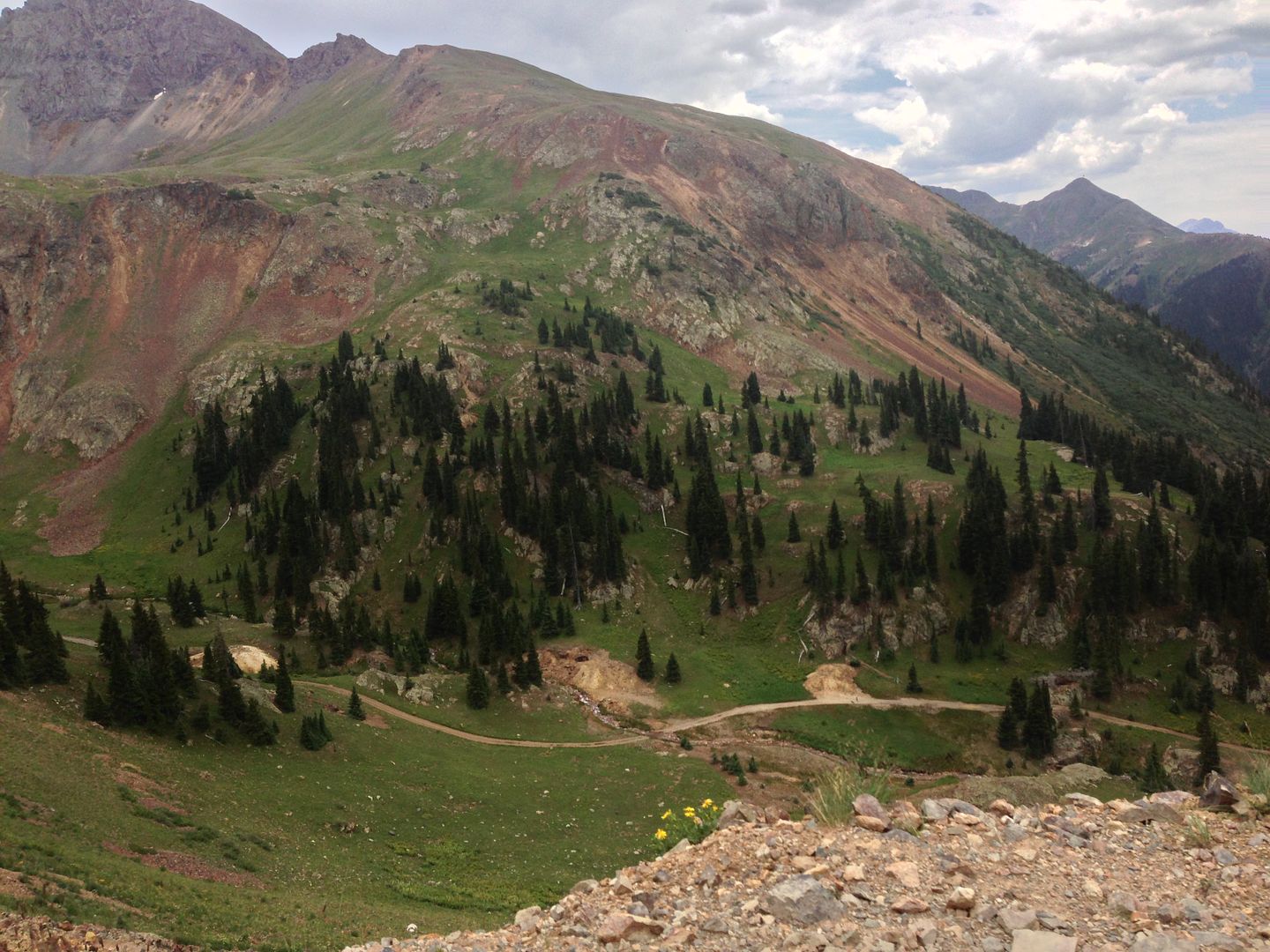
The views of the valley were breathtaking.
9372477221_21893f860d_c.jpg


It's kind of weird looking out, and seeing mountains BELOW you...


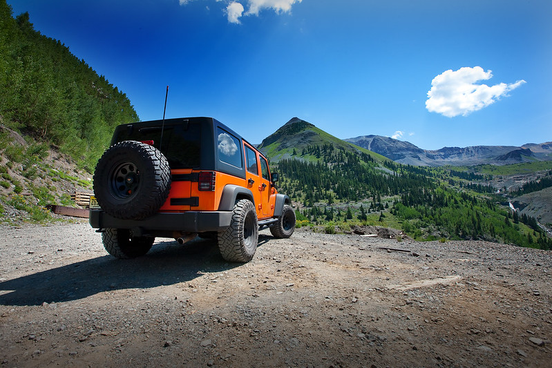
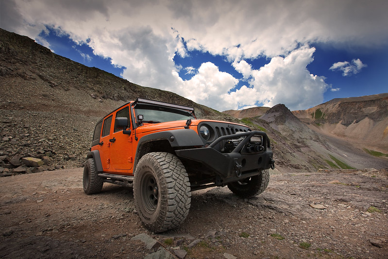
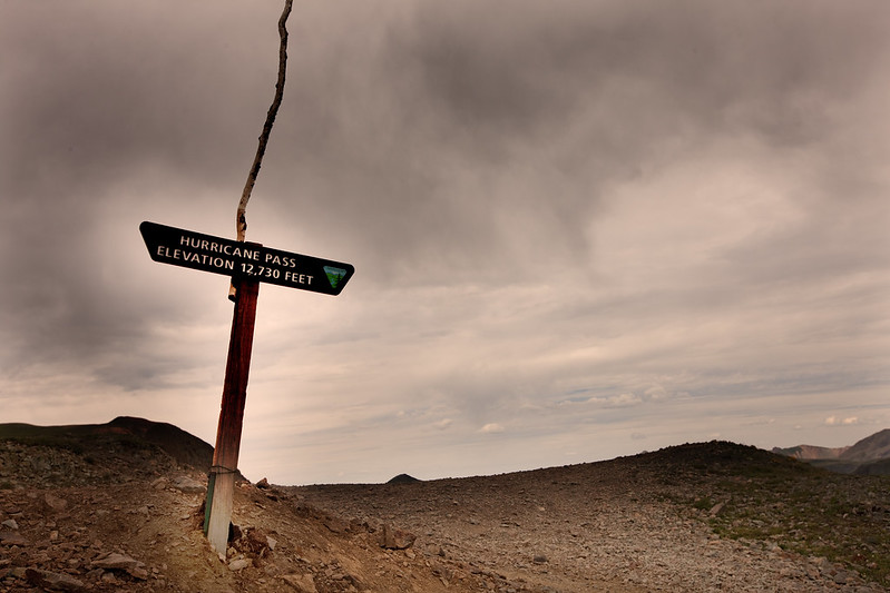
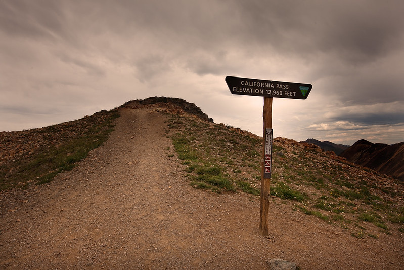
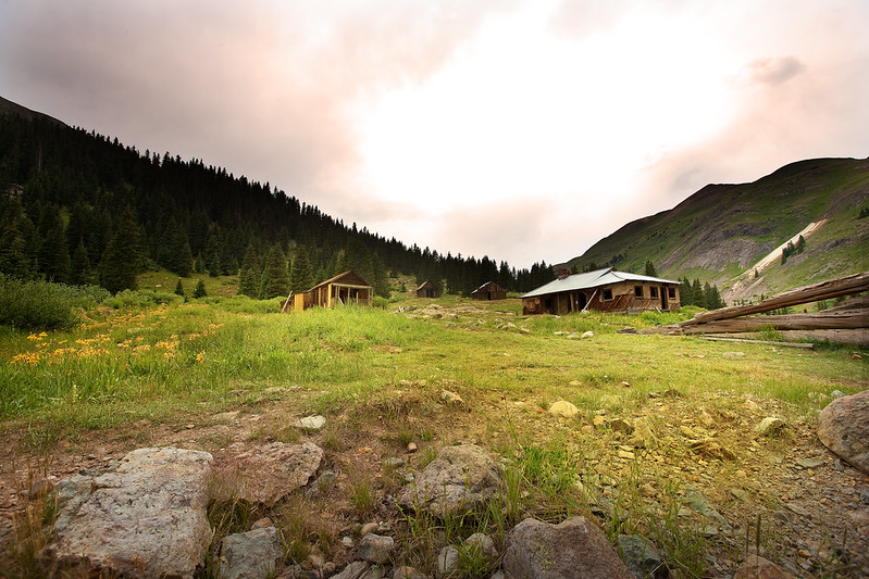
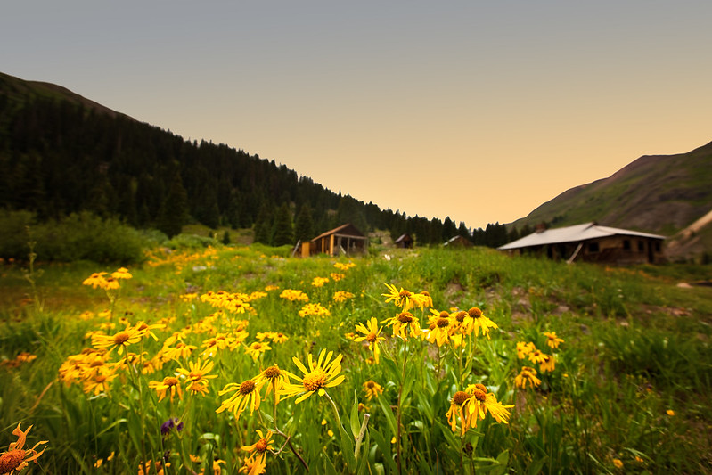
Once we drove the mild descent into Silverton, we grabbed some lunch, bought some souvenirs, it was time to head out for the next adventures of the day, Hurrican Pass to California Pass, to Animas Forks.

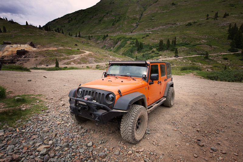
Now, I have been using a trail guidebook, along with GPS to make sure I stay on course, but I wasn't prepared for what was coming up soon.

Hurricane Pass is supposed to be (rated) an fairly mild trail. We climbed most of it without even needing 4WD.


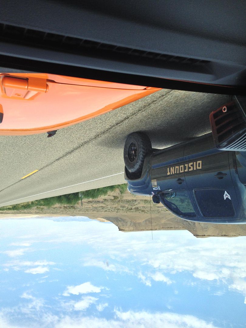
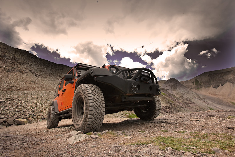
As we got higher up the mountain we came to a V intersection. Checking my guidebook there was no mention of such V and the GPS showed that both sides of the V are actually trails. So, without actually knowing where the path leads off I go....LEFT. This was a serious mistake that I will never make again. Driving on the path for about 15 minutes things were going ok. It was getting a tad rockier, but nothing of concern (although the terrain would be rated moderate by the guidebook, I should have sensed something was wrong.) After another 10 minutes, it began to get narrow, and very rocky...now Im starting to get slightly concerned. I stop, check the GPS, and indeed I am still "on a trail." So foolishly I keep going. After another mile of rocky terrain, I arrive at a very peaky summit. Literally 1 foot forward, the jeep tips forward. 1 foot back, the jeep tips back...it was as if I was resting on the top of a pyramid. So, glad that I wasn't climbing anymore, I continued onwards. After 1/4 mile of even rockier terrain, I reach something that really gave me a bad feeling, but again, checking the GPS, I was on a trail, so this entire time, I am thinking I am on a correct path. I start to descend this route, and I tell the wife to get out and film me. Now, we are all tough e thugs when it comes to the interwebz, but this actually had me nervous. The real reason I wanted her out of the Jeep is so that she doesn't see me nervous and doesn't panic herself. I didn't panic, but I was nervous.

So, down I go....the slope is probably 35 degrees, if not more, on some of the the most loose terrain I have ever driven on. I could feel the rear end sliding around, but it wasn't the rear end, it was the ground underneath the rear end! Nervously, but in control, I start to descend....until I get around a slight bend which opens up a view.....of a switchback.
http://www.youtube.com/watch?v=_Ul_2wUxX7A

Now I am really nervous. 500 foot drop offs, Im in a long a$$ unlimited, and I have to do Black Bear Pass style turns on some of the worst terrain I have come across. I make it past that first switchback, sweating, only to realize that I have 7 more to conquer. Great. I kept the wife out of the truck this entire time. She could barely walk on this slope and this terrain, and I was amazed I made it down. Big props to the Jeep for this one. Finally, after a heart pumping drive down, I make it off this hell on a mountain. The wife jumps back into the Jeep, and onwards.....or so I thought. We drove for about 1/4 mile on very rocky terrain again, and see a trail in the distance...


I figured, ok, we're on the right track, until I turn the next corner...which brought to straight to the edge of a cliff, and at that point I realized the real mistake I made. This was just a sideroad and not the main trail. This is a dead end. So, you guessed it, I now have to go back UP over hell on a mountain. Keeping my cool not letting my wife see me sweat, I kept making jokes like "I got this I got this" but the situation was not a joke. Lesson #1, if you have people around you that are depending on you, do not show them that you are nervous, it will make them even more nervous. Keep your cool, and logically get out of the situation. I threw her in 4LO, 1st gear, and up I went. Steady constant pace, slight drifts around the switchbacks so that I wouldn't have to back up, and steadily, I made it all the way up. The wife was pale white, as she was genuinely scared, as was I, but I didn't show it. Lesson #2, never go anywhere unless you are sure of where it leads, and lesson #3, never go anywhere unless you are positive you can get back out. I would say that if the slope was about 10 degrees steeper (maybe even 5) a vehicle wouldn't be able to drive over that loose rock, and would just dig itself in. Buttpuckering? You bet. Hell of a rush when you're safe? Absolutely. Would I do it again? Not a chance.
 

NFRs2000NYC

Caught the Bug
So, after a heartpumping, butt clinching, jawdropping climb back out of this hellhole, I made it back to the V, ready to head back the way I came, crawl back to my hotel and assume the fetal position. Luckily just as I made it back to the V, a few buggys were coming down the other side of the V, and after verifying with them that going RIGHT is the correct path, we plowed onwards.

After 15 minutes of driving, we arrived at the peak.

9372478823_4b39db5285_c.jpg


Coming down Hurricane Pass headed towards California Pass, we were greeted with the sight of lake Como. At this point both the wife and I calmed down, and were again enjoying ourselves.

9375256198_c1edaac270_c.jpg


After another 40 minutes or so of driving, we arrived at the peak of California Pass
9375257198_e486693545_c.jpg


We were now very close to Animas Forks, which is a genuine ghost town. Animas was a huge mining town and many of the structures still remain today, which you can explore. A very cool and eerie place.

Part of the old mine


Some of the homes still "standing"
9375259722_f7048a9f75_c.jpg


9375260384_8b40bcb39a_c.jpg


Parked in the middle of "town"
9372485459_b3cde8843a_c.jpg


Wildflowers everywhere!
9375261992_4078c995a1_c.jpg


Some houses were larger than others, I suspect some were management, some were laborers.
9372487953_c72b951e00_c.jpg


I guess commuting to work on horseback every morning was not practical, so they all lived right by the mine.
9375264338_ec80247758_c.jpg


A room with a view


The parks service (or whoever manages these lands) are constantly fixing these places up just enough so that they continue to stand and let others visit it.


Looked like a stable.


After leaving Animas Forks, and just before you get back to the main road, you come across yet another disused mine in the side of a mountain.


After a LONG day, we decided to take the highway back to Telluride and call it a day. Now as some of you know, Im a pretty seasoned Tail Of The Dragon driver, but it has been a LONG time since I have seen roads as awesome as these. So far, to me, the greatest driving road in the world.


Perfect terrain, views for miles, challenging bends, sweeping curves, it's got it all.


This poor guy almost got a taste of steel bumper at 50mph


For the 47th time, I wished I had my s2000 with me


On the way out of the trails, we saw more evidence of mining...


Old mining cart gondola


Silverton was a pretty cool town, with lots of history.
After a long LONG day, we grabbed dinner at Handlebars....


It is also a very Jeep friendly town...


Love a restaurant with a sense of humor


After dinner, we drove back to Telluride, and hit the sack. Once again, the road, especially at sunset was amazing.
 
Last edited:

tugoo

New member
Man, I think I ripped a hole in the couch from the pucker factor! Glad you made made it back safely! Keep the pics coming...


Sent from my iPhone using WAYALIFE mobile app
 

NFRs2000NYC

Caught the Bug
Man, I think I ripped a hole in the couch from the pucker factor! Glad you made made it back safely! Keep the pics coming...


Sent from my iPhone using WAYALIFE mobile app

Yea, I was really getting nervous at that point. I was more concerned for my wife's safety and really didn't want to rattle her. I kept her calm and "cheery" and she was able to continue the vacation without paying much attention to this incident. The adrenaline wore off pretty quickly. However, I have learned a number of lessons from it, so I guess not all is lost.
 

tugoo

New member
Thanks for sharing; your lessons are everyone's lessons. It is these shared experiences that really burn lessons into my mind!

On a lighter side all I could think of after reading was the old Bugs Bunny cartoon from when I was a kid where he would say "I knew I should of took that left turn at Albuquerque"! In your case it was a right!


Sent from my iPhone using WAYALIFE mobile app
 

NFRs2000NYC

Caught the Bug
Thanks for sharing; your lessons are everyone's lessons. It is these shared experiences that really burn lessons into my mind!

On a lighter side all I could think of after reading was the old Bugs Bunny cartoon from when I was a kid where he would say "I knew I should of took that left turn at Albuquerque"! In your case it was a right!


Sent from my iPhone using WAYALIFE mobile app

I actually used that line. When we got to the summit (before the hellroad) I literally turned to my wife and said "I tink I took a wrong toyn at Albuquerque lol"
 

tugoo

New member
Haha, that's what I would of said as well to keep the mood light!


Sent from my iPhone using WAYALIFE mobile app
 

NFRs2000NYC

Caught the Bug
DAY 4

Today would be a "relaxing day" and our last day in the San Juan mountains. If anyone asks you to envision what offroading in Colorado would be like, they are probably going to describe the San Juan's. They are just epic. On the way out of town, I saw a Land Rover Camel Trophy truck, which I found out later belonged to one of the guys that worked at our hotel.


The first stop of the day would be Yankee Boy Basin. This is a beautiful mountain pass with many amazing landscapes. As we started the strail, we encountered a deer. The poor thing had nowhere to go, so he ran up about a mile before he was able to pop to the right into the brush.


Heading up you Yankee boy was a gradual easy climb at first, although narrow in some spots.


Some more remnants of an old mine


Our first (and only stop) on Yankee Boy Basin were the Twin Falls. These waterfalls are used in the coors commercials.

9372492187_546861b168_c.jpg


9372493321_1e213a5a6f_c.jpg


9375269940_1e1574304f_c.jpg


9372495539_62b881bea9_c.jpg


9375274828_46d7e56491_c.jpg


Once again, the landscape was awash with wildflowers, really an amazing sight to behold.


9372500083_2ab755dc98_c.jpg


9375276470_554282aa59_c.jpg


9372502157_ec2e45428d_c.jpg


9375278310_938e135d1a_c.jpg


9375278976_b1aa81fa30_c.jpg


9375279812_39190140fd_c.jpg


This is probably one of the most beautiful spots in the entire state. (where the falls are.)
9372506425_9b0657d39a_c.jpg


9372438243_84ecfce77d_c.jpg


9375211944_96756f0558_c.jpg


9375211390_fe439074ba_c.jpg


At this time, it was the early afternoon, so we figured we had time to hit one more trail before heading back to town.
 
Top Bottom