WarriorJeep
New member
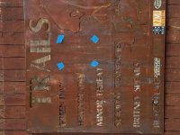
As some of you may recall I was gearing up and went on a 5500 off road trek across the U.S. called the Trans-America Trail. It started the same way most of our Jeep adventures do, and I started building the Jeep up to withstand it.
The why: Three reasons, primarily to benefit Special Operations Warrior Foundation. We generated $488.00 per dirt mile for the foundation. Second reason was because no Jeep had ever completed it contiguously, and it was a chance to make history. And lastly, well because I could.
It also gave me a chance to properly field test a great many items (for which I will give separate reviews) some were crap, some were meh, some were ok, and a few rose to the top and quite frankly a few shocked the hell out of me in a good way...
Next is Patagonia, possibly before years end. Except instead of taking the Pan-American Highway, i'll run the Dakar route from Tierra Del Fuego to as far North as it goes before I break out onto the tarmac again. What I need to do is map all dirt all the way to the Darian Gap. Now that would be cool!
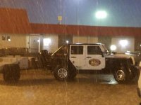
The Jeep day 1
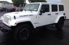
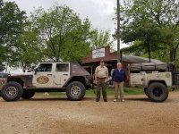
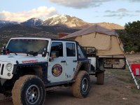
The Warrior Jeep
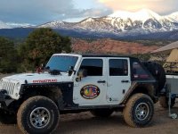
The Jeep is a 2015 JKURHR with the following mods:
Dynatrac PR44 and ProGrip brakes
BDS 4 1/2 SA lift
Raceline wheels
37x12.5x17 BFG KO2's
Warn Zeon 10-S
Bestop Trektop Pro
XRC Corner Armor
Smittybuilt MOD front bumper
Atlas rear bumper w tire carrier
I'll list the rest of whats inside and out later, these were the essentials.
Now for the story:
On April 28th 2016 at 0800 I arrived at the trailhead for the Transamerica Trail in Andrews, North Carolina feeling pretty confident that the Warrior Jeep and I would make history. With the sole purpose of raising money and awareness for wounded veterans of Special Forces through the Special Operations Warrior Foundation, this epic trip would be both a labor of love and a test of endurance for me. Back in January of the same year I had successfully undergone brain surgery for Parkinson's Disease, and had been implanted with a Deep Brain Stimulator. Not too long before that, I had to have my right knee replaced. I soon realized after we started the Jeep build the year prior that this project was going to test my mettle. I wasn’t wrong...
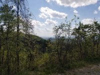
There was no fanfare, no photographers, just the silence of the Cherokee National Forest as we headed up the trail to our first stopping point more than 200 miles ahead. The Warrior Jeep, a 2015 Jeep Wrangler Rubicon Hard Rock Edition that had been modified to withstand anything that the trail could throw at it, and myself, a former Army Veteran, would be all that the trail would see for weeks until we reached Trinidad, Colorado where I would pick up my 18 year old son Jacoby, who would function as my Co-Driver and Navigator.
The Journey and Trail Challenges Begin
The Cherokee National Forest track proved to be interesting to say the least. Even though the trail was normally what I would consider to be a well-maintained forestry road, on more than one occasion I was required to utilize my winch, and the Warrior Jeep seemed happier in four-wheel drive with aired down tires. Water crossings and hairpin turns took me from an elevation of 1800 feet to over 5500 within just a few miles in certain places. Downed trees plagued the trail making it slow going; good thing I had a chainsaw with me! Covered with wood chips, dirt, and sweat, I hopped back into the Jeep only to see that from sunrise to sunset, I had only covered 120 miles of trail that first day. This meant that I needed to add to the trail miles I covered daily to meet the schedule the next day. What I didn’t realize was that in order to stay on schedule and reach Northern California on time, it would be necessary for me to cover 250 dirt miles per day.
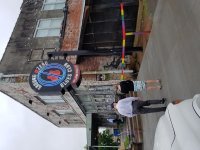
Mississippi would prove to be a long day with a breakfast stop to visit Sam Corerro, who originally mapped out the Transamerica Trail, and a visit to Clarksdale, MS, where the Mayor and his staff greeted me upon arrival. His honor, B. Luckett the mayor of Clarksdale, was also a co-owner in a local business called the Ground Zero Blues Club, where I was served quite possibly one of the best hamburgers I’ve ever eaten. I did take a moment to also visit with one of my sponsors, Genesis Off Road. Back on the trail conditions had gotten worse, in the distance tornado sirens were blaring and it was raining so hard I could barely see the road. I finally stopped under an overpass and waited it out; I really didn’t want to end up in Kansas by accident.
Southern Weather was Not Ready for Spring Yet
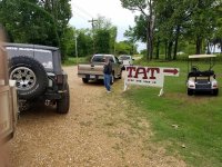
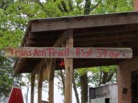
The Ozark National Forest was definitely different; I had to make a few adjustments to my plans as a result of not one, not two, but seemingly all of the campgrounds in the national forest being closed due to lack of staff. But once in Oklahoma I knew it would be fast going, straight runs for a hundred miles at a time and good weather would allow me to make up some time. As I crossed Oklahoma I stopped at two ranches that were each marked by large signs stating "TAT Sign-In Book". I looked back at the signatures and wondered to myself if any had started at the beginning, and how long it took them, as most were dual cross motorcycles. Back on the trail west, I also wondered what those pioneers saw crossing the plains, with the Rockies looming before them.
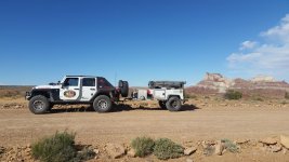
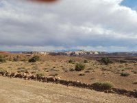
The days on the trail soon started to blur together, sometimes I would get brief cell signal and be able to speak with my wife who would invariably ask, "where are you?" I could never answer her without checking my GPS. There were a few points on the trail, which runs over 5,000 dirt miles across the United States, where I didn’t see another human for a couple of days at a time. The terrain changes were drastic as well, sometimes being above the snow line, while at other times being on the desert floor praying the hot winds would stop for just a few minutes. After nearly 3 weeks on the trail I reached Moab, UT and the schedule was starting to become a reality. We had to make it to Flagstaff, AZ for the opening day of Overland Expo 2016, and we had already been held up several days trying to cross the Rockies in Colorado. Time was no longer my friend...
More Rain and Mud When We Made it to Moab
We pulled into Area BFE in Moab, UT after 3 days of constant rain. The mud was so deep we had to continually try to clean several pounds of mud off our boots just to move. But the rain was not gone; overnight nearly half an inch of rainfall had already soaked the trails. By morning all we could do to grab breakfast and leave, it would be the first time on the trail that I had to use both lockers just to get moving. Thankfully once we got a few miles further west toward Gemini Bridges, the trail started to dry out. One benefit was that the rain helped keep the dust down. Once we got out past the trailhead to Metal Masher, we rolled out our trail changes into the Magellan eXplorist TRX7, which had thus far been invaluable to the trip.
Heading further into Utah is where we encountered what would be the only real malfunction on the Transamerica Trail. The Yaesu 2m radio we had onboard started to experience an intermittent problem, which was causing the microphone to key down randomly. Fortunately one of the greatest takeaways from my time in the military was the concept of redundancy "one is none, two is one", so once I installed the backup radio we were off again. But adversity was not behind us by any stretch, the trail started to disappear on us. Thick with brush, we just couldn’t see the trail at all in many places. Once we reached the Nevada and Utah border, I could see Wheeler Peak looming in the distance so I knew intuitively that I was heading in the right general direction, but again, we had to put all of our faith into what was being displayed on the Magellan TRX7 GPS. We ended up on a track running down a fence line that hovered between Utah and Nevada going due south. Aired down to 18 pounds of pressure in the front tires and 20 on the rear, Jacoby was calling out turns like a rally car navigator as I pushed the Warrior Jeep ahead on a track that only the GPS could see. We only had 6 hours before sunset and needed to cover nearly 180 trail miles that day to stay on schedule.
Finally, after a couple of hours we started to trail west and Duckwater Peak began to come into view - a welcome sight after the day we had. We camped just south of Duckwater Peak for the night. The morning brought a new set of tracks, and a new set of problems associated with them. We knew we needed to start heading northwest toward Northern California's Goose Lake, but we weren’t sure exactly where. I don’t typically like to rely solely on technology for anything, certainly not navigation, but I would eventually do just that. Once we reached an area just south of Massacre Lake in Northern Nevada, we could breath a bit easier. It was just a few short hours more until we reached a camping spot I knew about in Northern California just inside the state line. Once there we took a full day to assess gear and supplies, and take care of any trail repairs we might need before making a run for the coast.
California: Our Final “Run to the Coast”
Our "run to the coast" was a bit more difficult that I had anticipated. The winter had taken its toll on the California forestry roads. Washed out trails, down trees, and patches of lingering snow were the norm, and add to it a few water crossings that would have given second thoughts to even the most seasoned off-roaders. I had planned on 2 days of trails before we moved out onto the highways of coastal California and headed for the Pacific Ocean, however the trails had different plans. Finally after 3 and a half days of California's worst (or so we thought), we aired back up and hit the highway headed for the coast. It would be the first time either of us had seen the Pacific in a very long time, but the work was not done yet. After a brief photo shoot at the Pacific Ocean, we headed south to a planned stop for maintenance at a team member’s home in Concord, California. As we pulled into Mark Harris's driveway, we discussed the maintenance plan - rotate all 5 of the 37-inch BFG KO2's, change the fluids front to rear, clean as best we could inside and out, wash clothes, and eat a meal we didn’t have to cook!
We made it to Mark's house and began our chores, and that Tuesday my co-driver flew back home. The next day I loaded back up and started the 2-day drive to Flagstaff, AZ, spending the night camping in the depths of the Mojave Desert. If my suspicions were correct, and they were, it would be the last quiet night sleep I would have until I got back home after Overland Expo 2016.
To Be Continued
The why: Three reasons, primarily to benefit Special Operations Warrior Foundation. We generated $488.00 per dirt mile for the foundation. Second reason was because no Jeep had ever completed it contiguously, and it was a chance to make history. And lastly, well because I could.
It also gave me a chance to properly field test a great many items (for which I will give separate reviews) some were crap, some were meh, some were ok, and a few rose to the top and quite frankly a few shocked the hell out of me in a good way...
Next is Patagonia, possibly before years end. Except instead of taking the Pan-American Highway, i'll run the Dakar route from Tierra Del Fuego to as far North as it goes before I break out onto the tarmac again. What I need to do is map all dirt all the way to the Darian Gap. Now that would be cool!
The Jeep day 1

The Warrior Jeep

The Jeep is a 2015 JKURHR with the following mods:
Dynatrac PR44 and ProGrip brakes
BDS 4 1/2 SA lift
Raceline wheels
37x12.5x17 BFG KO2's
Warn Zeon 10-S
Bestop Trektop Pro
XRC Corner Armor
Smittybuilt MOD front bumper
Atlas rear bumper w tire carrier
I'll list the rest of whats inside and out later, these were the essentials.
Now for the story:
On April 28th 2016 at 0800 I arrived at the trailhead for the Transamerica Trail in Andrews, North Carolina feeling pretty confident that the Warrior Jeep and I would make history. With the sole purpose of raising money and awareness for wounded veterans of Special Forces through the Special Operations Warrior Foundation, this epic trip would be both a labor of love and a test of endurance for me. Back in January of the same year I had successfully undergone brain surgery for Parkinson's Disease, and had been implanted with a Deep Brain Stimulator. Not too long before that, I had to have my right knee replaced. I soon realized after we started the Jeep build the year prior that this project was going to test my mettle. I wasn’t wrong...
There was no fanfare, no photographers, just the silence of the Cherokee National Forest as we headed up the trail to our first stopping point more than 200 miles ahead. The Warrior Jeep, a 2015 Jeep Wrangler Rubicon Hard Rock Edition that had been modified to withstand anything that the trail could throw at it, and myself, a former Army Veteran, would be all that the trail would see for weeks until we reached Trinidad, Colorado where I would pick up my 18 year old son Jacoby, who would function as my Co-Driver and Navigator.
The Journey and Trail Challenges Begin
The Cherokee National Forest track proved to be interesting to say the least. Even though the trail was normally what I would consider to be a well-maintained forestry road, on more than one occasion I was required to utilize my winch, and the Warrior Jeep seemed happier in four-wheel drive with aired down tires. Water crossings and hairpin turns took me from an elevation of 1800 feet to over 5500 within just a few miles in certain places. Downed trees plagued the trail making it slow going; good thing I had a chainsaw with me! Covered with wood chips, dirt, and sweat, I hopped back into the Jeep only to see that from sunrise to sunset, I had only covered 120 miles of trail that first day. This meant that I needed to add to the trail miles I covered daily to meet the schedule the next day. What I didn’t realize was that in order to stay on schedule and reach Northern California on time, it would be necessary for me to cover 250 dirt miles per day.
Mississippi would prove to be a long day with a breakfast stop to visit Sam Corerro, who originally mapped out the Transamerica Trail, and a visit to Clarksdale, MS, where the Mayor and his staff greeted me upon arrival. His honor, B. Luckett the mayor of Clarksdale, was also a co-owner in a local business called the Ground Zero Blues Club, where I was served quite possibly one of the best hamburgers I’ve ever eaten. I did take a moment to also visit with one of my sponsors, Genesis Off Road. Back on the trail conditions had gotten worse, in the distance tornado sirens were blaring and it was raining so hard I could barely see the road. I finally stopped under an overpass and waited it out; I really didn’t want to end up in Kansas by accident.
Southern Weather was Not Ready for Spring Yet
The Ozark National Forest was definitely different; I had to make a few adjustments to my plans as a result of not one, not two, but seemingly all of the campgrounds in the national forest being closed due to lack of staff. But once in Oklahoma I knew it would be fast going, straight runs for a hundred miles at a time and good weather would allow me to make up some time. As I crossed Oklahoma I stopped at two ranches that were each marked by large signs stating "TAT Sign-In Book". I looked back at the signatures and wondered to myself if any had started at the beginning, and how long it took them, as most were dual cross motorcycles. Back on the trail west, I also wondered what those pioneers saw crossing the plains, with the Rockies looming before them.
The days on the trail soon started to blur together, sometimes I would get brief cell signal and be able to speak with my wife who would invariably ask, "where are you?" I could never answer her without checking my GPS. There were a few points on the trail, which runs over 5,000 dirt miles across the United States, where I didn’t see another human for a couple of days at a time. The terrain changes were drastic as well, sometimes being above the snow line, while at other times being on the desert floor praying the hot winds would stop for just a few minutes. After nearly 3 weeks on the trail I reached Moab, UT and the schedule was starting to become a reality. We had to make it to Flagstaff, AZ for the opening day of Overland Expo 2016, and we had already been held up several days trying to cross the Rockies in Colorado. Time was no longer my friend...
More Rain and Mud When We Made it to Moab
We pulled into Area BFE in Moab, UT after 3 days of constant rain. The mud was so deep we had to continually try to clean several pounds of mud off our boots just to move. But the rain was not gone; overnight nearly half an inch of rainfall had already soaked the trails. By morning all we could do to grab breakfast and leave, it would be the first time on the trail that I had to use both lockers just to get moving. Thankfully once we got a few miles further west toward Gemini Bridges, the trail started to dry out. One benefit was that the rain helped keep the dust down. Once we got out past the trailhead to Metal Masher, we rolled out our trail changes into the Magellan eXplorist TRX7, which had thus far been invaluable to the trip.
Heading further into Utah is where we encountered what would be the only real malfunction on the Transamerica Trail. The Yaesu 2m radio we had onboard started to experience an intermittent problem, which was causing the microphone to key down randomly. Fortunately one of the greatest takeaways from my time in the military was the concept of redundancy "one is none, two is one", so once I installed the backup radio we were off again. But adversity was not behind us by any stretch, the trail started to disappear on us. Thick with brush, we just couldn’t see the trail at all in many places. Once we reached the Nevada and Utah border, I could see Wheeler Peak looming in the distance so I knew intuitively that I was heading in the right general direction, but again, we had to put all of our faith into what was being displayed on the Magellan TRX7 GPS. We ended up on a track running down a fence line that hovered between Utah and Nevada going due south. Aired down to 18 pounds of pressure in the front tires and 20 on the rear, Jacoby was calling out turns like a rally car navigator as I pushed the Warrior Jeep ahead on a track that only the GPS could see. We only had 6 hours before sunset and needed to cover nearly 180 trail miles that day to stay on schedule.
Finally, after a couple of hours we started to trail west and Duckwater Peak began to come into view - a welcome sight after the day we had. We camped just south of Duckwater Peak for the night. The morning brought a new set of tracks, and a new set of problems associated with them. We knew we needed to start heading northwest toward Northern California's Goose Lake, but we weren’t sure exactly where. I don’t typically like to rely solely on technology for anything, certainly not navigation, but I would eventually do just that. Once we reached an area just south of Massacre Lake in Northern Nevada, we could breath a bit easier. It was just a few short hours more until we reached a camping spot I knew about in Northern California just inside the state line. Once there we took a full day to assess gear and supplies, and take care of any trail repairs we might need before making a run for the coast.
California: Our Final “Run to the Coast”
Our "run to the coast" was a bit more difficult that I had anticipated. The winter had taken its toll on the California forestry roads. Washed out trails, down trees, and patches of lingering snow were the norm, and add to it a few water crossings that would have given second thoughts to even the most seasoned off-roaders. I had planned on 2 days of trails before we moved out onto the highways of coastal California and headed for the Pacific Ocean, however the trails had different plans. Finally after 3 and a half days of California's worst (or so we thought), we aired back up and hit the highway headed for the coast. It would be the first time either of us had seen the Pacific in a very long time, but the work was not done yet. After a brief photo shoot at the Pacific Ocean, we headed south to a planned stop for maintenance at a team member’s home in Concord, California. As we pulled into Mark Harris's driveway, we discussed the maintenance plan - rotate all 5 of the 37-inch BFG KO2's, change the fluids front to rear, clean as best we could inside and out, wash clothes, and eat a meal we didn’t have to cook!
We made it to Mark's house and began our chores, and that Tuesday my co-driver flew back home. The next day I loaded back up and started the 2-day drive to Flagstaff, AZ, spending the night camping in the depths of the Mojave Desert. If my suspicions were correct, and they were, it would be the last quiet night sleep I would have until I got back home after Overland Expo 2016.
To Be Continued

